Earthquake MOLUCCA SEA
Fri, 16 Jan 2026 02:20:41 GMT
Time1 month ago
Location
0.5700, 125.1400
Depth
13.0 KM
Event Summary
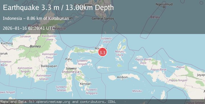
A 3.3 magnitude earthquake struck on MOLUCCA SEA, at Fri, 16 Jan 2026 02:20:41 GMT. Depth: 13km. Reviewed by BMKG seismologists, this minor quake occurred at a magnitude type of m.
Magnitude
3.3
m
Source
BMKG
Intensity
-
Agency Reports
1 Sources| Source | Magnitude | Depth | Time |
|---|---|---|---|
| BMKGPrimary | 3.3 | 13 km | 1 month ago |
Earthquake Details
AutomaticEvent IDemsc_BMKG_20260116_0000032
Tsunami PotentialNo
Magnitude Typem
Nearest Places
- Pulau Pakolor49.9 km
- Pulau Balingbaling50.9 km
- Pulau Punten51.5 km
- Pulau Bentenan51.8 km
- Tanjung Sompini53.0 km
Comments
Join the discussion about this event.
Latest Earthquakes
1.9Mag
Tarapaca, Chile
Time3 minutes ago
Depth107.06 km
SourceVYT (Automatic)
3.0Mag
Java, Indonesia
Time3 minutes ago
Depth0.00 km
SourceVYT (Automatic)
0.6Mag
2 km W of Anza, CA
Time7 minutes ago
Depth2.81 km
SourceUSGS (Automatic)
5.0Mag
Fox Islands, Aleutian Islands, Alaska
Time10 minutes ago
Depth0.00 km
SourceVYT (Automatic)
3.4Mag
southern Peru
Time14 minutes ago
Depth204.47 km
SourceVYT (Automatic)
Nearby Earthquakes
2.8Mag
MOLUCCA SEA
Time1 month ago
Depth17.00 km
SourceBMKG (Automatic)
4.0Mag
MOLUCCA SEA
Time2 years ago
Depth32.00 km
SourceBMKG (Automatic)
3.5Mag
Northern Molucca Sea
Time2 weeks ago
Depth16.12 km
SourceBMKG (Automatic)
3.0Mag
MOLUCCA SEA
Time9 months ago
Depth23.00 km
SourceBMKG (Automatic)
2.7Mag
MOLUCCA SEA
Time1 month ago
Depth10.00 km
SourceBMKG (Automatic)