Earthquake Northern Molucca Sea
Mon, 02 Feb 2026 14:02:29 GMT
Time3 hours ago
Location
0.4679, 125.1602
Depth
16.1 KM
Event Summary
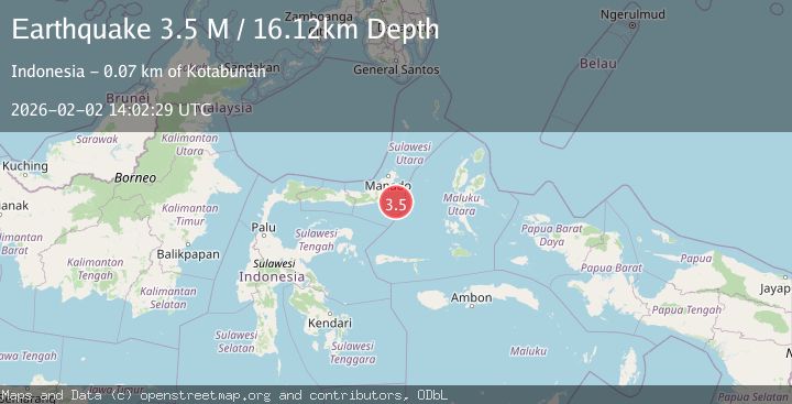
A 3.5 magnitude earthquake struck on Northern Molucca Sea, at Mon, 02 Feb 2026 14:02:29 GMT. Depth: 16.116484km. Reviewed by BMKG seismologists, this minor quake occurred at a magnitude type of M.
Magnitude
3.5
M
Source
BMKG
Intensity
-
Agency Reports
1 Sources| Source | Magnitude | Depth | Time |
|---|---|---|---|
| BMKGPrimary | 3.5 | 16 km | 3 hours ago |
Earthquake Details
AutomaticEvent IDbmg2026chnx
Tsunami PotentialNo
Magnitude TypeM
Nearest Places
- Pulau Pakolor61.2 km
- Pulau Balingbaling61.8 km
- Pulau Punten62.3 km
- Kepulauan Dakokayu62.7 km
- Pulau Bentenan62.9 km
Comments
Join the discussion about this event.
Latest Earthquakes
4.5Mag
VALPARAISO, CHILE
Time4 hours ago
Depth112.10 km
SourceCSN (Automatic)
1.2Mag
17 km S of Tres Pinos, CA
Time4 hours ago
Depth5.50 km
SourceUSGS (Automatic)
1.3Mag
8 km NW of The Geysers, CA
Time4 hours ago
Depth1.85 km
SourceUSGS (Automatic)
2.6Mag
SAN JUAN, ARGENTINA
Time4 hours ago
Depth104.00 km
SourceNSNA (Automatic)
1.0Mag
4 km W of Borrego Springs, CA
Time4 hours ago
Depth4.56 km
SourceUSGS (Automatic)
Nearby Earthquakes
3.4Mag
Northern Molucca Sea
Time1 week ago
Depth11.41 km
SourceBMKG (Automatic)
2.9Mag
MINAHASA, SULAWESI, INDONESIA
Time1 week ago
Depth18.00 km
SourceBMKG (Automatic)
4.4Mag
Southern Molucca Sea
Time5 days ago
Depth10.00 km
SourceBMKG (Automatic)
3.5Mag
Southern Molucca Sea
Time5 hours ago
Depth11.57 km
SourceBMKG (Automatic)
3.0Mag
MOLUCCA SEA
Time1 week ago
Depth9.00 km
SourceBMKG (Automatic)