Earthquake MOLUCCA SEA
Fri, 16 Jan 2026 12:57:19 GMT
Time1 month ago
Location
1.7800, 125.9100
Depth
91.0 KM
Event Summary
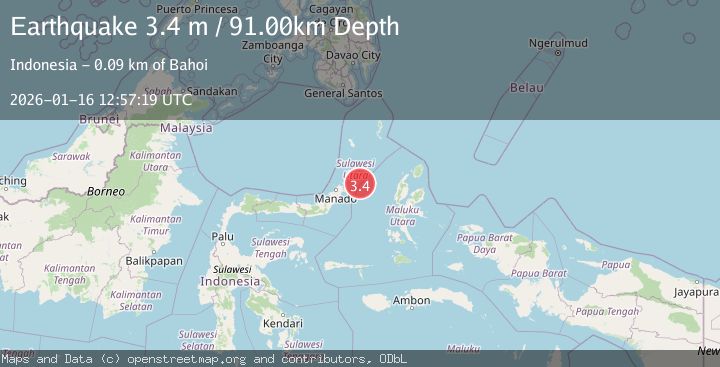
A 3.4 magnitude earthquake struck on MOLUCCA SEA, at Fri, 16 Jan 2026 12:57:19 GMT. Depth: 91km. Reviewed by BMKG seismologists, this minor quake occurred at a magnitude type of m.
Magnitude
3.4
m
Source
BMKG
Intensity
-
Agency Reports
1 Sources| Source | Magnitude | Depth | Time |
|---|---|---|---|
| BMKGPrimary | 3.4 | 91 km | 1 month ago |
Earthquake Details
AutomaticEvent IDemsc_BMKG_20260116_0000236
Tsunami PotentialNo
Magnitude Typem
Nearest Places
- Pulau Batumeo66.3 km
- Tonggeng Kalioho66.4 km
- Tonggeng Bahu66.5 km
- Tonggeng Lensehe66.8 km
- Teluk Karira67.3 km
Comments
Join the discussion about this event.
Latest Earthquakes
1.9Mag
Poland
Time15 minutes ago
Depth10.01 km
SourceVYT (Automatic)
1.6Mag
10 km W of Pine Valley, CA
Time23 minutes ago
Depth16.88 km
SourceUSGS (Automatic)
2.4Mag
West Papua Region, Indonesia
Time23 minutes ago
Depth10.00 km
SourceBMKG
4.5Mag
Tarapaca, Chile
Time28 minutes ago
Depth128.42 km
SourceVYT (Automatic)
2.3Mag
PUERTO RICO
Time34 minutes ago
Depth15.50 km
SourcePR (Automatic)
Nearby Earthquakes
4.0Mag
MOLUCCA SEA
Time6 years ago
Depth12.00 km
SourceDJA (Automatic)
4.0Mag
MOLUCCA SEA
Time6 years ago
Depth28.00 km
SourceDJA (Automatic)
5.3Mag
MOLUCCA SEA
Time20 years ago
Depth10.00 km
SourceEMSC (Automatic)
3.0Mag
MOLUCCA SEA
Time9 months ago
Depth15.00 km
SourceBMKG (Automatic)
6.0Mag
MOLUCCA SEA
Time20 years ago
Depth33.00 km
SourceEMSC (Automatic)