Earthquake SUMBA REGION, INDONESIA
Fri, 16 Jan 2026 17:25:28 GMT
Time1 month ago
Location
-10.0600, 119.0800
Depth
10.0 KM
Event Summary
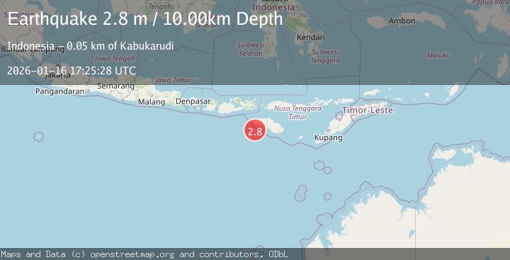
A 2.8 magnitude earthquake struck on SUMBA REGION, INDONESIA, at Fri, 16 Jan 2026 17:25:28 GMT. Depth: 10km. Reviewed by BMKG seismologists, this minor quake occurred at a magnitude type of m.
Magnitude
2.8
m
Source
BMKG
Intensity
-
Agency Reports
1 Sources| Source | Magnitude | Depth | Time |
|---|---|---|---|
| BMKGPrimary | 2.8 | 10 km | 1 month ago |
Earthquake Details
AutomaticEvent IDemsc_BMKG_20260116_0000305
Tsunami PotentialNo
Magnitude Typem
Nearest Places
- Watu Kalode36.0 km
- Tanjung Mambang36.3 km
- Tanjung Toroha36.5 km
- Loko Watukalabar36.8 km
- Teluk Katobo36.8 km
Comments
Join the discussion about this event.
Latest Earthquakes
2.7Mag
South Australia
Time17 hours ago
Depth264.28 km
SourceVYT (Automatic)
2.2Mag
FRANCE
Time17 hours ago
Depth5.00 km
SourceReNaSS (Automatic)
2.6Mag
WESTERN TURKEY
Time17 hours ago
Depth9.70 km
SourceKOERI (Automatic)
1.7Mag
Southeastern Alaska
Time17 hours ago
Depth18.43 km
SourceVYT (Automatic)
2.7Mag
Java, Indonesia
Time17 hours ago
Depth19.90 km
SourceBMKG
Nearby Earthquakes
3.0Mag
SUMBA REGION, INDONESIA
Time6 years ago
Depth15.00 km
SourceDJA (Automatic)
3.5Mag
Sumba region, Indonesia
Time3 days ago
Depth0.00 km
SourceVYT (Automatic)
5.6Mag
SUMBA REGION, INDONESIA
Time10 months ago
Depth25.00 km
SourceEMSC (Automatic)
4.0Mag
SUMBA REGION, INDONESIA
Time7 years ago
Depth24.00 km
SourceDJA (Automatic)
3.0Mag
SUMBA REGION, INDONESIA
Time2 years ago
Depth10.00 km
SourceDJA (Automatic)