Earthquake MOLUCCA SEA
Sat, 17 Jan 2026 12:53:24 GMT
Time1 month ago
Location
-0.0600, 124.4600
Depth
11.0 KM
Event Summary
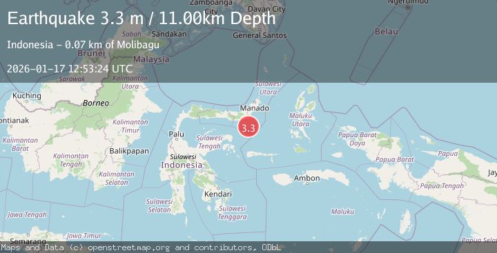
A 3.3 magnitude earthquake struck on MOLUCCA SEA, at Sat, 17 Jan 2026 12:53:24 GMT. Depth: 11km. Reviewed by BMKG seismologists, this minor quake occurred at a magnitude type of m.
Magnitude
3.3
m
Source
BMKG
Intensity
-
Agency Reports
1 Sources| Source | Magnitude | Depth | Time |
|---|---|---|---|
| BMKGPrimary | 3.3 | 11 km | 1 month ago |
Earthquake Details
AutomaticEvent IDemsc_BMKG_20260117_0000136
Tsunami PotentialNo
Magnitude Typem
Nearest Places
- Libuton Pondanmointok54.5 km
- Pulau-pulau Batutolu54.8 km
- Impoda Bulu54.8 km
- Tanjung Bokka54.9 km
- Libuton Pondanmoloben55.1 km
Comments
Join the discussion about this event.
Latest Earthquakes
1.4Mag
EASTERN TURKEY
Time9 minutes ago
Depth6.80 km
SourceAFAD (Automatic)
1.9Mag
6 km SW of Fuig, Puerto Rico
Time10 minutes ago
Depth13.76 km
SourceUSGS
1.7Mag
northern Alaska
Time10 minutes ago
Depth4.64 km
SourceVYT (Automatic)
1.2Mag
5 km WNW of The Geysers, CA
Time16 minutes ago
Depth3.19 km
SourceUSGS (Automatic)
3.4Mag
Sulawesi, Indonesia
Time19 minutes ago
Depth27.95 km
SourceVYT (Automatic)
Nearby Earthquakes
3.0Mag
MOLUCCA SEA
Time2 years ago
Depth25.00 km
SourceDJA (Automatic)
3.0Mag
MOLUCCA SEA
Time10 months ago
Depth14.00 km
SourceBMKG (Automatic)
5.1Mag
MOLUCCA SEA
Time17 years ago
Depth76.00 km
SourceEMSC (Automatic)
4.0Mag
MOLUCCA SEA
Time6 years ago
Depth10.00 km
SourceDJA (Automatic)
4.0Mag
MOLUCCA SEA
Time9 months ago
Depth25.00 km
SourceBMKG (Automatic)