Earthquake MOLUCCA SEA
Sat, 17 Jan 2026 16:08:16 GMT
Time1 month ago
Location
0.8400, 126.1200
Depth
20.0 KM
Event Summary
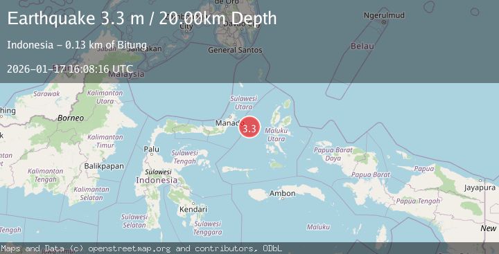
A 3.3 magnitude earthquake struck on MOLUCCA SEA, at Sat, 17 Jan 2026 16:08:16 GMT. Depth: 20km. Reviewed by BMKG seismologists, this minor quake occurred at a magnitude type of m.
Magnitude
3.3
m
Source
BMKG
Intensity
-
Agency Reports
1 Sources| Source | Magnitude | Depth | Time |
|---|---|---|---|
| BMKGPrimary | 3.3 | 20 km | 1 month ago |
Earthquake Details
AutomaticEvent IDemsc_BMKG_20260117_0000181
Tsunami PotentialNo
Magnitude Typem
Nearest Places
- Kelurahan Tifure14.5 km
- Pulau Tifore15.0 km
- Kelurahan Pantai Sagu15.4 km
- Pulau Gureda16.6 km
- Maluku Sea40.1 km
Comments
Join the discussion about this event.
Latest Earthquakes
2.9Mag
Sumbawa Region, Indonesia
Time10 hours ago
Depth53.96 km
SourceBMKG
0.8Mag
Southern Alaska
Time10 hours ago
Depth15.50 km
SourceVYT (Automatic)
4.4Mag
North of Halmahera, Indonesia
Time10 hours ago
Depth30.29 km
SourceBMKG
3.0Mag
Seram, Indonesia
Time10 hours ago
Depth3.59 km
SourceBMKG
3.4Mag
Rat Islands, Aleutian Islands, Alaska
Time10 hours ago
Depth112.18 km
SourceVYT (Automatic)
Nearby Earthquakes
3.0Mag
MOLUCCA SEA
Time1 year ago
Depth10.00 km
SourceBMKG (Automatic)
5.1Mag
MOLUCCA SEA
Time4 years ago
Depth40.00 km
SourceEMSC (Automatic)
5.8Mag
MOLUCCA SEA
Time17 years ago
Depth25.00 km
SourceEMSC (Automatic)
5.0Mag
MOLUCCA SEA
Time4 years ago
Depth40.00 km
SourceEMSC (Automatic)
3.3Mag
MOLUCCA SEA
Time1 month ago
Depth10.00 km
SourceBMKG (Automatic)