Earthquake FLORES REGION, INDONESIA
Sat, 17 Jan 2026 22:17:39 GMT
Time1 month ago
Location
-8.3100, 120.0000
Depth
168.0 KM
Event Summary
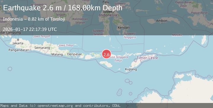
A 2.6 magnitude earthquake struck on FLORES REGION, INDONESIA, at Sat, 17 Jan 2026 22:17:39 GMT. Depth: 168km. Reviewed by BMKG seismologists, this minor quake occurred at a magnitude type of m.
Magnitude
2.6
m
Source
BMKG
Intensity
-
Agency Reports
1 Sources| Source | Magnitude | Depth | Time |
|---|---|---|---|
| BMKGPrimary | 2.6 | 168 km | 1 month ago |
Earthquake Details
AutomaticEvent IDemsc_BMKG_20260117_0000275
Tsunami PotentialNo
Magnitude Typem
Nearest Places
- Pulau Sababi6.2 km
- Selat Gili Bodo7.8 km
- Tanjung Pontianak8.4 km
- Tanjung Kokotuku8.7 km
- Teluk Gusohdongkalang9.4 km
Comments
Join the discussion about this event.
Latest Earthquakes
2.8Mag
Sulawesi, Indonesia
Time4 minutes ago
Depth21.08 km
SourceBMKG
2.1Mag
WESTERN TURKEY
Time8 minutes ago
Depth12.30 km
SourceKOERI (Automatic)
2.2Mag
Alaska Peninsula
Time8 minutes ago
Depth57.74 km
SourceVYT (Automatic)
3.8Mag
WESTERN TURKEY
Time11 minutes ago
Depth13.30 km
SourceKOERI (Automatic)
1.6Mag
27 km ESE of Balmorhea, Texas
Time11 minutes ago
Depth3.56 km
SourceUSGS (Automatic)
Nearby Earthquakes
3.0Mag
FLORES REGION, INDONESIA
Time1 year ago
Depth176.00 km
SourceBMKG (Automatic)
3.0Mag
FLORES REGION, INDONESIA
Time5 months ago
Depth152.00 km
SourceBMKG (Automatic)
4.0Mag
FLORES REGION, INDONESIA
Time3 years ago
Depth170.00 km
SourceDJA (Automatic)
2.7Mag
Flores Region, Indonesia
Time1 week ago
Depth169.17 km
SourceBMKG (Automatic)
3.0Mag
FLORES REGION, INDONESIA
Time7 months ago
Depth157.00 km
SourceBMKG (Automatic)