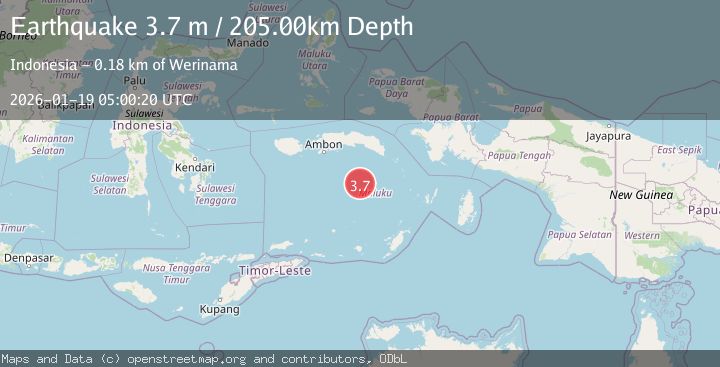
Earthquake BANDA SEA
Mon, 19 Jan 2026 05:00:20 GMT
Time1 month ago
Location
-5.0800, 129.7800
Depth
205.0 KM
Event Summary
A 3.7 magnitude earthquake struck on BANDA SEA, at Mon, 19 Jan 2026 05:00:20 GMT. Depth: 205km. Reviewed by BMKG seismologists, this minor quake occurred at a magnitude type of m.
Magnitude
3.7
m
Source
BMKG
Intensity
-
Agency Reports
1 Sources| Source | Magnitude | Depth | Time |
|---|---|---|---|
| BMKGPrimary | 3.7 | 205 km | 1 month ago |
Earthquake Details
AutomaticEvent IDemsc_BMKG_20260119_0000060
Tsunami PotentialNo
Magnitude Typem
Nearest Places
- Cagar Alam / Taman Laut Banda55.9 km
- Tanjung Nama58.2 km
- Karang Hatta58.4 km
- Gunung Gandulang58.7 km
- Tanjung Batu Layar58.8 km
Comments
Join the discussion about this event.
Latest Earthquakes
1.6Mag
Kenai Peninsula, Alaska
Time5 minutes ago
Depth42.60 km
SourceVYT (Automatic)
2.4Mag
Finland
Time8 minutes ago
Depth301.88 km
SourceVYT (Automatic)
1.2Mag
Alaska Peninsula
Time8 minutes ago
Depth0.12 km
SourceVYT (Automatic)
4.1Mag
NEAR COAST OF NORTHERN PERU
Time13 minutes ago
Depth35.00 km
SourceLIM (Automatic)
3.1Mag
DODECANESE IS.-TURKEY BORDER REG
Time14 minutes ago
Depth4.10 km
SourceKOERI (Automatic)
Nearby Earthquakes
2.9Mag
Banda Sea
Time17 hours ago
Depth19.17 km
SourceVYT (Automatic)
4.0Mag
BANDA SEA
Time4 years ago
Depth238.00 km
SourceDJA (Automatic)
4.0Mag
BANDA SEA
Time4 months ago
Depth197.00 km
SourceBMKG (Automatic)
4.0Mag
BANDA SEA
Time2 years ago
Depth189.00 km
SourceDJA (Automatic)
5.1Mag
BANDA SEA
Time1 year ago
Depth119.60 km
SourceNEIC (Automatic)