Earthquake Banda Sea
Tue, 17 Feb 2026 19:57:33 GMT
Time16 hours ago
Location
-5.0173, 129.7616
Depth
19.2 KM
Event Summary
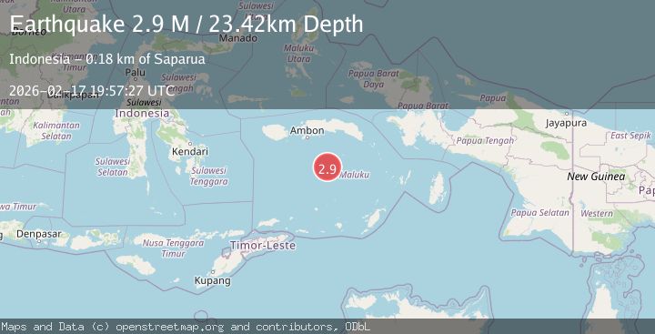
A 2.9 magnitude earthquake struck on Banda Sea, at Tue, 17 Feb 2026 19:57:33 GMT. Depth: 19.1650390625km. Reviewed by VYT seismologists, this minor quake occurred at a magnitude type of earthquake.
Magnitude
2.9
earthquake
Source
VYT
Intensity
-
Agency Reports
1 Sources| Source | Magnitude | Depth | Time |
|---|---|---|---|
| VYTPrimary | 2.9 | 19 km | 16 hours ago |
Earthquake Details
AutomaticEvent IDvyt_12eqabnqx0wy5
Tsunami PotentialNo
Magnitude Typeearthquake
Nearest Places
- Cagar Alam / Taman Laut Banda49.4 km
- Gunung Gandulang51.5 km
- Tanjung Noret51.7 km
- Tanjung Nama51.8 km
- Pulau Run52.1 km
Comments
Join the discussion about this event.
Latest Earthquakes
2.3Mag
Poland
Time16 hours ago
Depth0.00 km
SourceVYT (Automatic)
1.6Mag
SPAIN
Time16 hours ago
Depth6.90 km
SourceIGN (Automatic)
1.9Mag
3 km SSW of Anderson Springs, CA
Time16 hours ago
Depth1.58 km
SourceUSGS (Automatic)
1.6Mag
41 km WNW of Mentone, Texas
Time16 hours ago
Depth0.00 km
SourceUSGS (Automatic)
1.0Mag
5 km WNW of Cobb, CA
Time16 hours ago
Depth2.12 km
SourceUSGS (Automatic)
Nearby Earthquakes
3.7Mag
BANDA SEA
Time1 month ago
Depth205.00 km
SourceBMKG (Automatic)
4.0Mag
BANDA SEA
Time2 years ago
Depth189.00 km
SourceDJA (Automatic)
5.8Mag
BANDA SEA
Time20 years ago
Depth33.00 km
SourceEMSC (Automatic)
4.0Mag
BANDA SEA
Time1 year ago
Depth192.00 km
SourceBMKG (Automatic)
6.1Mag
BANDA SEA
Time5 years ago
Depth183.00 km
SourceEMSC (Automatic)