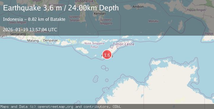
Earthquake TIMOR REGION, INDONESIA
Mon, 19 Jan 2026 13:57:04 GMT
Time1 month ago
Location
-10.4000, 123.6100
Depth
24.0 KM
Event Summary
A 3.6 magnitude earthquake struck on TIMOR REGION, INDONESIA, at Mon, 19 Jan 2026 13:57:04 GMT. Depth: 24km. Reviewed by BMKG seismologists, this minor quake occurred at a magnitude type of m.
Magnitude
3.6
m
Source
BMKG
Intensity
-
Agency Reports
1 Sources| Source | Magnitude | Depth | Time |
|---|---|---|---|
| BMKGPrimary | 3.6 | 29 km | 1 month ago |
Earthquake Details
AutomaticEvent IDemsc_BMKG_20260119_0000168
Tsunami PotentialNo
Magnitude Typem
Nearest Places
- Tanjung Nainoni3.3 km
- Tubu Lobok3.7 km
- Teluk Sekalak4.5 km
- Aidoloak4.6 km
- Fetonai4.8 km
Comments
Join the discussion about this event.
Latest Earthquakes
1.6Mag
Southern Alaska
Time2 hours ago
Depth48.58 km
SourceVYT (Automatic)
2.3Mag
Antofagasta, Chile
Time2 hours ago
Depth82.15 km
SourceVYT (Automatic)
2.1Mag
Southern Alaska
Time2 hours ago
Depth64.21 km
SourceVYT (Automatic)
2.5Mag
Central Alaska
Time2 hours ago
Depth312.99 km
SourceVYT (Automatic)
3.6Mag
Banda Sea
Time2 hours ago
Depth0.00 km
SourceVYT (Automatic)
Nearby Earthquakes
3.0Mag
TIMOR REGION, INDONESIA
Time1 month ago
Depth17.00 km
SourceBMKG (Automatic)
2.6Mag
TIMOR REGION, INDONESIA
Time1 month ago
Depth30.00 km
SourceBMKG (Automatic)
5.0Mag
TIMOR REGION, INDONESIA
Time15 years ago
Depth45.00 km
SourceEMSC (Automatic)
3.3Mag
TIMOR REGION, INDONESIA
Time1 month ago
Depth14.00 km
SourceBMKG (Automatic)
5.1Mag
TIMOR REGION, INDONESIA
Time3 years ago
Depth10.00 km
SourceEMSC (Automatic)