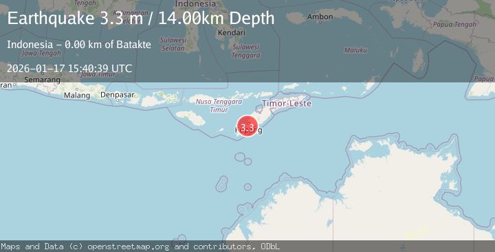
Earthquake TIMOR REGION, INDONESIA
Sat, 17 Jan 2026 15:40:39 GMT
Time1 month ago
Location
-10.3000, 123.5500
Depth
14.0 KM
Event Summary
A 3.3 magnitude earthquake struck on TIMOR REGION, INDONESIA, at Sat, 17 Jan 2026 15:40:39 GMT. Depth: 14km. Reviewed by BMKG seismologists, this minor quake occurred at a magnitude type of m.
Magnitude
3.3
m
Source
BMKG
Intensity
-
Agency Reports
1 Sources| Source | Magnitude | Depth | Time |
|---|---|---|---|
| BMKGPrimary | 3.3 | 9 km | 1 month ago |
Earthquake Details
AutomaticEvent IDemsc_BMKG_20260117_0000177
Tsunami PotentialNo
Magnitude Typem
Nearest Places
- Sumlili0.3 km
- Oeseni0.6 km
- Oebatu0.8 km
- Cekdam Sumlili Satu1.2 km
- Noe Oenesu1.3 km
Comments
Join the discussion about this event.
Latest Earthquakes
1.9Mag
Central Alaska
Time2 minutes ago
Depth7.57 km
SourceVYT (Automatic)
1.5Mag
Central California
Time2 minutes ago
Depth0.00 km
SourceVYT (Automatic)
0.7Mag
Washington
Time4 minutes ago
Depth0.00 km
SourceVYT (Automatic)
2.8Mag
Antofagasta, Chile
Time7 minutes ago
Depth102.66 km
SourceVYT (Automatic)
2.8Mag
Minahassa Peninsula, Sulawesi
Time8 minutes ago
Depth11.18 km
SourceBMKG
Nearby Earthquakes
4.0Mag
TIMOR REGION, INDONESIA
Time1 month ago
Depth13.00 km
SourceBMKG (Automatic)
2.6Mag
TIMOR REGION, INDONESIA
Time1 month ago
Depth11.00 km
SourceBMKG (Automatic)
3.6Mag
TIMOR REGION, INDONESIA
Time1 month ago
Depth24.00 km
SourceBMKG (Automatic)
3.0Mag
TIMOR REGION, INDONESIA
Time0 months ago
Depth17.00 km
SourceBMKG (Automatic)
5.2Mag
TIMOR REGION, INDONESIA
Time10 years ago
Depth10.00 km
SourceEMSC (Automatic)