Earthquake SOUTHERN SUMATRA, INDONESIA
Mon, 19 Jan 2026 19:34:26 GMT
Time1 month ago
Location
-5.2200, 102.7600
Depth
29.0 KM
Event Summary
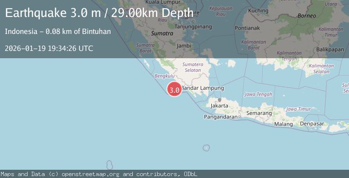
A 3.0 magnitude earthquake struck on SOUTHERN SUMATRA, INDONESIA, at Mon, 19 Jan 2026 19:34:26 GMT. Depth: 29km. Reviewed by BMKG seismologists, this minor quake occurred at a magnitude type of m.
Magnitude
3.0
m
Source
BMKG
Intensity
-
Agency Reports
1 Sources| Source | Magnitude | Depth | Time |
|---|---|---|---|
| BMKGPrimary | 3.0 | 29 km | 1 month ago |
Earthquake Details
AutomaticEvent IDemsc_BMKG_20260119_0000276
Tsunami PotentialNo
Magnitude Typem
Nearest Places
- Tanjung Kaana44.3 km
- Teluk Enggano45.0 km
- Tanjung Kanuhujo45.4 km
- Kajaapu47.1 km
- Taoabi47.2 km
Comments
Join the discussion about this event.
Latest Earthquakes
2.2Mag
western Texas
Time2 minutes ago
Depth0.24 km
SourceVYT (Automatic)
2.2Mag
Valparaiso, Chile
Time3 minutes ago
Depth22.83 km
SourceVYT (Automatic)
4.5Mag
Central Alaska
Time4 minutes ago
Depth7.81 km
SourceVYT (Automatic)
1.9Mag
1 km SSW of Pāhala, Hawaii
Time8 minutes ago
Depth28.47 km
SourceUSGS (Automatic)
1.5Mag
5 km NW of The Geysers, CA
Time9 minutes ago
Depth2.47 km
SourceUSGS (Automatic)
Nearby Earthquakes
5.3Mag
SOUTHERN SUMATRA, INDONESIA
Time9 years ago
Depth52.00 km
SourceEMSC (Automatic)
3.3Mag
SOUTHERN SUMATRA, INDONESIA
Time1 month ago
Depth29.00 km
SourceBMKG (Automatic)
5.0Mag
SOUTHERN SUMATRA, INDONESIA
Time19 years ago
Depth30.00 km
SourceEMSC (Automatic)
3.0Mag
SOUTHERN SUMATRA, INDONESIA
Time1 year ago
Depth10.00 km
SourceBMKG (Automatic)
3.0Mag
SOUTHERN SUMATRA, INDONESIA
Time2 months ago
Depth9.00 km
SourceBMKG (Automatic)