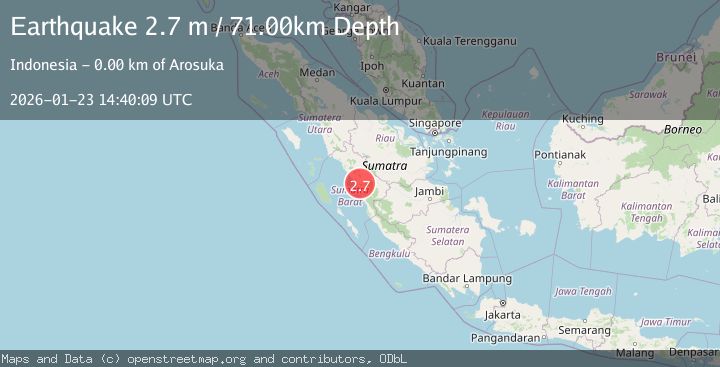
Earthquake SOUTHERN SUMATRA, INDONESIA
Fri, 23 Jan 2026 14:40:09 GMT
Time1 month ago
Location
-0.9300, 100.5900
Depth
71.0 KM
Event Summary
A 2.7 magnitude earthquake struck on SOUTHERN SUMATRA, INDONESIA, at Fri, 23 Jan 2026 14:40:09 GMT. Depth: 71km. Reviewed by BMKG seismologists, this minor quake occurred at a magnitude type of m.
Magnitude
2.7
m
Source
BMKG
Intensity
-
Agency Reports
1 Sources| Source | Magnitude | Depth | Time |
|---|---|---|---|
| BMKGPrimary | 2.7 | 71 km | 1 month ago |
Earthquake Details
AutomaticEvent IDemsc_BMKG_20260123_0000255
Tsunami PotentialNo
Magnitude Typem
Nearest Places
- 0.7 km
- 2.8 km
- 2.9 km
- 3.5 km
- 3.5 km
Comments
Join the discussion about this event.
Latest Earthquakes
2.3Mag
Tarapaca, Chile
Time3 minutes ago
Depth128.05 km
SourceVYT (Automatic)
1.2Mag
Southeastern Alaska
Time5 minutes ago
Depth0.00 km
SourceVYT (Automatic)
2.3Mag
134 km E of Chignik, Alaska
Time7 minutes ago
Depth53.90 km
SourceUSGS (Automatic)
1.3Mag
Kenai Peninsula, Alaska
Time9 minutes ago
Depth31.37 km
SourceVYT (Automatic)
2.1Mag
Tarapaca, Chile
Time9 minutes ago
Depth0.00 km
SourceVYT (Automatic)
Nearby Earthquakes
3.0Mag
SOUTHERN SUMATRA, INDONESIA
Time3 years ago
Depth10.00 km
SourceDJA (Automatic)
3.0Mag
SOUTHERN SUMATRA, INDONESIA
Time5 months ago
Depth99.00 km
SourceBMKG (Automatic)
5.2Mag
SOUTHERN SUMATRA, INDONESIA
Time7 years ago
Depth42.00 km
SourceEMSC (Automatic)
2.6Mag
southern Sumatra, Indonesia
Time6 days ago
Depth0.00 km
SourceVYT (Automatic)
3.0Mag
SOUTHERN SUMATRA, INDONESIA
Time5 years ago
Depth75.00 km
SourceDJA (Automatic)