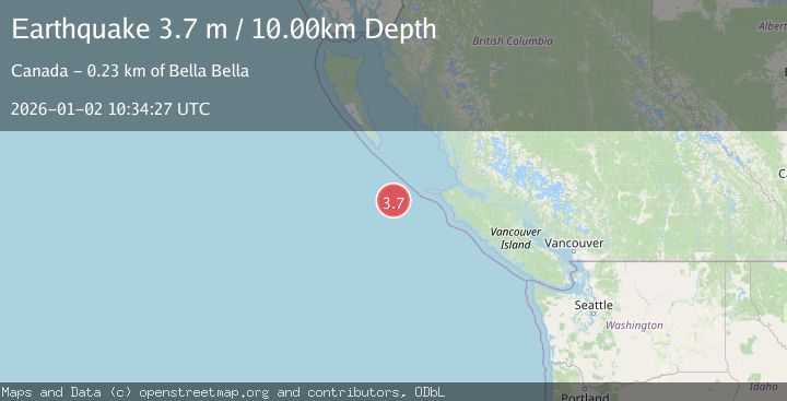
Earthquake VANCOUVER ISLAND, CANADA REGION
Fri, 02 Jan 2026 10:34:27 GMT
Time1 month ago
Location
50.5710, -130.3684
Depth
10.0 KM
Event Summary
A 3.7 magnitude earthquake struck on VANCOUVER ISLAND, CANADA REGION, at Fri, 02 Jan 2026 10:34:27 GMT. Depth: 10km. Reviewed by CN seismologists, this minor quake occurred at a magnitude type of m.
Magnitude
3.7
m
Source
CN
Intensity
-
Agency Reports
1 Sources| Source | Magnitude | Depth | Time |
|---|---|---|---|
| CNPrimary | 3.7 | 10 km | 1 month ago |
Earthquake Details
AutomaticEvent IDemsc_CN_20260102_0000360
Tsunami PotentialNo
Magnitude Typem
Nearest Places
- 16.6 km
- 16.9 km
- 23.9 km
- 27.5 km
- 37.9 km
Comments
Join the discussion about this event.
Latest Earthquakes
1.1Mag
6 km WNW of Cobb, CA
Time4 hours ago
Depth0.99 km
SourceUSGS (Automatic)
1.9Mag
Central Alaska
Time4 hours ago
Depth13.06 km
SourceVYT (Automatic)
1.4Mag
Southeastern Alaska
Time4 hours ago
Depth15.87 km
SourceVYT (Automatic)
3.4Mag
Vancouver Island, Canada region
Time4 hours ago
Depth10.00 km
SourceVYT (Automatic)
1.7Mag
Arizona
Time4 hours ago
Depth0.00 km
SourceVYT (Automatic)
Nearby Earthquakes
3.0Mag
VANCOUVER ISLAND, CANADA REGION
Time2 years ago
Depth10.00 km
SourceCN (Automatic)
3.0Mag
VANCOUVER ISLAND, CANADA REGION
Time1 month ago
Depth10.00 km
SourceCN (Automatic)
3.0Mag
VANCOUVER ISLAND, CANADA REGION
Time4 months ago
Depth10.00 km
SourceCN (Automatic)
3.0Mag
VANCOUVER ISLAND, CANADA REGION
Time9 months ago
Depth10.00 km
SourceCN (Automatic)
3.0Mag
VANCOUVER ISLAND, CANADA REGION
Time11 months ago
Depth10.00 km
SourceCN (Automatic)