Earthquake MOLUCCA SEA
Mon, 17 Dec 2018 11:38:42 GMT
Time7 years ago
Location
2.6600, 127.1700
Depth
117.0 KM
Event Summary
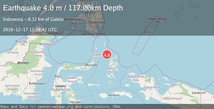
A 4.0 magnitude earthquake struck on MOLUCCA SEA, at Mon, 17 Dec 2018 11:38:42 GMT. Depth: 117km. Reviewed by DJA seismologists, this light quake occurred at a magnitude type of m.
Magnitude
4.0
m
Source
DJA
Intensity
-
Agency Reports
1 Sources| Source | Magnitude | Depth | Time |
|---|---|---|---|
| DJAPrimary | 4.0 | 117 km | 7 years ago |
Earthquake Details
AutomaticEvent IDemsc_DJA_20181217_0000055
Tsunami PotentialNo
Magnitude Typem
Nearest Places
- Pulau Deherete76.7 km
- Pulau Sedeng78.6 km
- Pulau Laba78.7 km
- Desa Cera79.5 km
- Pulau Karis80.0 km
Comments
Join the discussion about this event.
Latest Earthquakes
2.8Mag
Fox Islands, Aleutian Islands, Alaska
Time3 minutes ago
Depth80.44 km
SourceVYT (Automatic)
0.9Mag
110 km S of McCarthy, Alaska
Time5 minutes ago
Depth18.50 km
SourceUSGS (Automatic)
3.0Mag
Central Alaska
Time6 minutes ago
Depth0.12 km
SourceVYT (Automatic)
2.5Mag
Minahassa Peninsula, Sulawesi
Time7 minutes ago
Depth4.95 km
SourceBMKG
2.9Mag
Minahasa, Sulawesi, Indonesia
Time7 minutes ago
Depth10.86 km
SourceVYT (Automatic)
Nearby Earthquakes
5.5Mag
MOLUCCA SEA
Time18 years ago
Depth80.00 km
SourceEMSC (Automatic)
5.5Mag
MOLUCCA SEA
Time3 years ago
Depth55.00 km
SourceEMSC (Automatic)
5.3Mag
MOLUCCA SEA
Time18 years ago
Depth35.00 km
SourceEMSC (Automatic)
3.2Mag
Northern Molucca Sea
Time3 weeks ago
Depth10.37 km
SourceBMKG (Automatic)
2.9Mag
Northern Molucca Sea
Time2 weeks ago
Depth10.00 km
SourceBMKG (Automatic)