Earthquake SIMEULUE, INDONESIA
Thu, 17 Jan 2019 06:05:40 GMT
Time7 years ago
Location
2.4900, 96.7700
Depth
50.0 KM
Event Summary
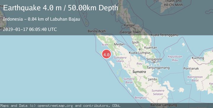
A 4.0 magnitude earthquake struck on SIMEULUE, INDONESIA, at Thu, 17 Jan 2019 06:05:40 GMT. Depth: 50km. Reviewed by DJA seismologists, this light quake occurred at a magnitude type of m.
Magnitude
4.0
m
Source
DJA
Intensity
-
Agency Reports
1 Sources| Source | Magnitude | Depth | Time |
|---|---|---|---|
| DJAPrimary | 4.0 | 50 km | 7 years ago |
Earthquake Details
AutomaticEvent IDemsc_DJA_20190117_0000028
Tsunami PotentialNo
Magnitude Typem
Nearest Places
- Pulau Batu Selayar30.8 km
- Pulau Batu Belahir31.3 km
- Ujung Silingar32.8 km
- Ujung Labuhanbaja33.1 km
- Tanjung Matankeli33.3 km
Comments
Join the discussion about this event.
Latest Earthquakes
1.7Mag
2 km NW of Enterprise, Nevada
Time8 minutes ago
Depth15.89 km
SourceUSGS (Automatic)
1.3Mag
Southeastern Alaska
Time10 minutes ago
Depth7.20 km
SourceVYT (Automatic)
0.8Mag
39 km NE of Amboy, Washington
Time11 minutes ago
Depth7.36 km
SourceUSGS (Automatic)
3.2Mag
ANDHRA PRADESH, INDIA
Time15 minutes ago
Depth4.70 km
SourceNDI (Automatic)
0.7Mag
10 km WNW of The Geysers, CA
Time17 minutes ago
Depth2.56 km
SourceUSGS (Automatic)
Nearby Earthquakes
5.1Mag
SIMEULUE, INDONESIA
Time20 years ago
Depth60.00 km
SourceEMSC (Automatic)
2.5Mag
Northern Sumatra, Indonesia
Time4 hours ago
Depth9.93 km
SourceBMKG
3.0Mag
SIMEULUE, INDONESIA
Time2 years ago
Depth10.00 km
SourceDJA (Automatic)
5.0Mag
SIMEULUE, INDONESIA
Time20 years ago
Depth33.00 km
SourceEMSC (Automatic)
5.0Mag
SIMEULUE, INDONESIA
Time20 years ago
Depth33.00 km
SourceEMSC (Automatic)