Earthquake SOUTH OF BALI, INDONESIA
Tue, 26 Jan 2021 21:53:35 GMT
Time5 years ago
Location
-9.5700, 115.6500
Depth
10.0 KM
Event Summary
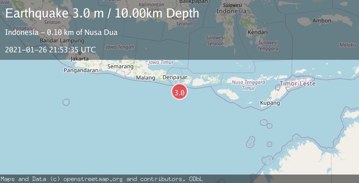
A 3.0 magnitude earthquake struck on SOUTH OF BALI, INDONESIA, at Tue, 26 Jan 2021 21:53:35 GMT. Depth: 10km. Reviewed by DJA seismologists, this minor quake occurred at a magnitude type of m.
Magnitude
3.0
m
Source
DJA
Intensity
-
Agency Reports
1 Sources| Source | Magnitude | Depth | Time |
|---|---|---|---|
| DJAPrimary | 3.0 | 10 km | 5 years ago |
Earthquake Details
AutomaticEvent IDemsc_DJA_20210126_0000205
Tsunami PotentialNo
Magnitude Typem
Nearest Places
- Lombok Basin48.3 km
- Pulau Sophialouisa81.6 km
- Gili Sarangburung83.6 km
- Tanjung Bakung83.8 km
- Teluk Sedihing84.0 km
Comments
Join the discussion about this event.
Latest Earthquakes
1.9Mag
Poland
Time39 seconds ago
Depth12.33 km
SourceVYT (Automatic)
1.7Mag
2 km NW of Enterprise, Nevada
Time9 minutes ago
Depth15.89 km
SourceUSGS (Automatic)
1.3Mag
Southeastern Alaska
Time10 minutes ago
Depth7.20 km
SourceVYT (Automatic)
0.8Mag
39 km NE of Amboy, Washington
Time11 minutes ago
Depth7.36 km
SourceUSGS (Automatic)
3.2Mag
ANDHRA PRADESH, INDIA
Time15 minutes ago
Depth4.70 km
SourceNDI (Automatic)
Nearby Earthquakes
2.6Mag
South of Bali, Indonesia
Time1 week ago
Depth14.96 km
SourceBMKG (Automatic)
3.0Mag
SOUTH OF BALI, INDONESIA
Time2 months ago
Depth10.00 km
SourceBMKG (Automatic)
4.0Mag
SOUTH OF BALI, INDONESIA
Time4 years ago
Depth12.00 km
SourceDJA (Automatic)
3.0Mag
SOUTH OF BALI, INDONESIA
Time4 years ago
Depth10.00 km
SourceDJA (Automatic)
3.0Mag
SOUTH OF BALI, INDONESIA
Time1 year ago
Depth18.00 km
SourceBMKG (Automatic)