Earthquake HALMAHERA, INDONESIA
Wed, 10 Feb 2021 11:08:38 GMT
Time5 years ago
Location
1.1000, 128.4200
Depth
10.0 KM
Event Summary
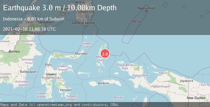
A 3.0 magnitude earthquake struck on HALMAHERA, INDONESIA, at Wed, 10 Feb 2021 11:08:38 GMT. Depth: 10km. Reviewed by DJA seismologists, this minor quake occurred at a magnitude type of m.
Magnitude
3.0
m
Source
DJA
Intensity
-
Agency Reports
1 Sources| Source | Magnitude | Depth | Time |
|---|---|---|---|
| DJAPrimary | 3.0 | 10 km | 5 years ago |
Earthquake Details
AutomaticEvent IDemsc_DJA_20210210_0000091
Tsunami PotentialNo
Magnitude Typem
Nearest Places
- Desa Wayamli3.5 km
- Air Geledangan5.5 km
- Air Bawes7.0 km
- Kecamatan Maba Tengah8.1 km
- Gunung Isalai9.1 km
Comments
Join the discussion about this event.
Latest Earthquakes
1.7Mag
40 km NW of Toyah, Texas
Time15 hours ago
Depth4.25 km
SourceUSGS (Automatic)
1.3Mag
SWITZERLAND
Time15 hours ago
Depth7.60 km
SourceETHZ (Automatic)
2.7Mag
Andreanof Islands, Aleutian Islands, Alaska
Time15 hours ago
Depth29.17 km
SourceVYT (Automatic)
1.6Mag
44 km NW of Toyah, Texas
Time15 hours ago
Depth0.00 km
SourceUSGS (Automatic)
2.2Mag
Washington
Time15 hours ago
Depth27.59 km
SourceVYT (Automatic)
Nearby Earthquakes
3.0Mag
HALMAHERA, INDONESIA
Time2 months ago
Depth10.00 km
SourceBMKG (Automatic)
3.0Mag
HALMAHERA, INDONESIA
Time11 months ago
Depth10.00 km
SourceBMKG (Automatic)
5.4Mag
HALMAHERA, INDONESIA
Time2 months ago
Depth16.00 km
SourceEMSC (Automatic)
3.0Mag
HALMAHERA, INDONESIA
Time2 years ago
Depth10.00 km
SourceBMKG (Automatic)
3.0Mag
HALMAHERA, INDONESIA
Time4 years ago
Depth14.00 km
SourceDJA (Automatic)