Earthquake HALMAHERA, INDONESIA
Fri, 12 Feb 2021 02:26:36 GMT
Time5 years ago
Location
1.9600, 127.2300
Depth
73.0 KM
Event Summary
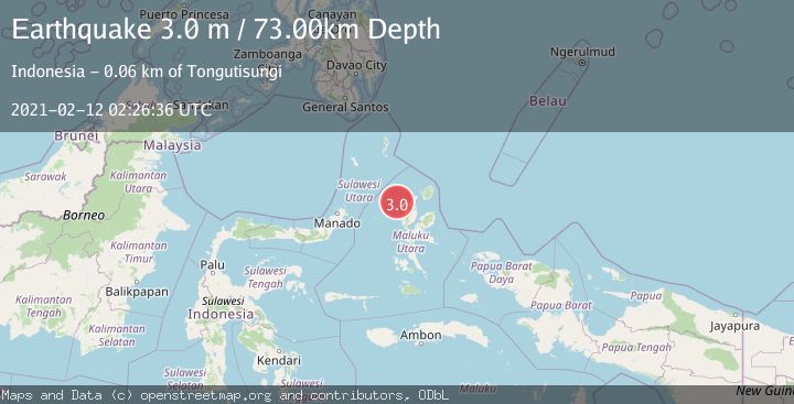
A 3.0 magnitude earthquake struck on HALMAHERA, INDONESIA, at Fri, 12 Feb 2021 02:26:36 GMT. Depth: 73km. Reviewed by DJA seismologists, this minor quake occurred at a magnitude type of m.
Magnitude
3.0
m
Source
DJA
Intensity
-
Agency Reports
1 Sources| Source | Magnitude | Depth | Time |
|---|---|---|---|
| DJAPrimary | 3.0 | 73 km | 5 years ago |
Earthquake Details
AutomaticEvent IDemsc_DJA_20210212_0000021
Tsunami PotentialNo
Magnitude Typem
Nearest Places
- Pulau Tutu41.8 km
- Tanjung Tutumadehe42.0 km
- Tanjung Tobadiku-mhe42.5 km
- Pulau Moreporoco42.9 km
- Pulau Tongidi43.0 km
Comments
Join the discussion about this event.
Latest Earthquakes
3.0Mag
Poland
Time53 seconds ago
Depth0.24 km
SourceVYT (Automatic)
4.5Mag
North of Halmahera, Indonesia
Time11 minutes ago
Depth10.00 km
SourceBMKG
4.1Mag
WESTERN XIZANG
Time12 minutes ago
Depth188.80 km
SourceNDI (Automatic)
3.1Mag
Bali Region, Indonesia
Time17 minutes ago
Depth19.14 km
SourceBMKG
2.7Mag
Coquimbo, Chile
Time18 minutes ago
Depth14.16 km
SourceVYT (Automatic)
Nearby Earthquakes
2.7Mag
HALMAHERA, INDONESIA
Time1 month ago
Depth10.00 km
SourceBMKG (Automatic)
3.0Mag
HALMAHERA, INDONESIA
Time2 years ago
Depth82.00 km
SourceBMKG (Automatic)
5.8Mag
MOLUCCA SEA
Time15 years ago
Depth108.00 km
SourceEMSC (Automatic)
3.0Mag
HALMAHERA, INDONESIA
Time8 months ago
Depth36.00 km
SourceBMKG (Automatic)
2.7Mag
HALMAHERA, INDONESIA
Time1 month ago
Depth92.00 km
SourceBMKG (Automatic)