Earthquake BANDA SEA
Wed, 13 Oct 2004 20:35:35 GMT
Time21 years ago
Location
-5.5800, 130.4200
Depth
33.0 KM
Event Summary
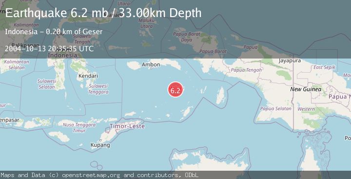
A 6.2 magnitude earthquake struck on BANDA SEA, at Wed, 13 Oct 2004 20:35:35 GMT. Depth: 33km. Reviewed by EMSC seismologists, this strong quake occurred at a magnitude type of mb.
Magnitude
6.2
mb
Source
EMSC
Intensity
-
Agency Reports
1 Sources| Source | Magnitude | Depth | Time |
|---|---|---|---|
| EMSCPrimary | 6.2 | 33 km | 21 years ago |
Earthquake Details
AutomaticEvent IDemsc_EMSC_20041013_0000024
Tsunami PotentialNo
Magnitude Typemb
Nearest Places
- Pulau Manuk13.3 km
- Weber Basin79.4 km
- Banda Trench91.0 km
- Waru92.1 km
- Pulau Serua92.7 km
Comments
Join the discussion about this event.
Latest Earthquakes
2.9Mag
Sumbawa Region, Indonesia
Time2 hours ago
Depth53.96 km
SourceBMKG
0.8Mag
Southern Alaska
Time2 hours ago
Depth15.50 km
SourceVYT (Automatic)
3.3Mag
Banda Sea
Time2 hours ago
Depth161.74 km
SourceVYT (Automatic)
4.4Mag
North of Halmahera, Indonesia
Time2 hours ago
Depth30.29 km
SourceBMKG
3.0Mag
Seram, Indonesia
Time2 hours ago
Depth3.59 km
SourceBMKG
Nearby Earthquakes
5.7Mag
BANDA SEA
Time19 years ago
Depth130.00 km
SourceEMSC (Automatic)
5.5Mag
BANDA SEA
Time15 years ago
Depth198.00 km
SourceEMSC (Automatic)
3.3Mag
Banda Sea
Time2 hours ago
Depth161.74 km
SourceVYT (Automatic)
4.0Mag
BANDA SEA
Time2 years ago
Depth167.00 km
SourceBMKG (Automatic)
5.3Mag
BANDA SEA
Time2 years ago
Depth10.00 km
SourceEMSC (Automatic)