Earthquake KEPULAUAN BABAR, INDONESIA
Sun, 01 Jan 2006 19:32:31 GMT
Time20 years ago
Location
-7.1600, 129.4700
Depth
100.0 KM
Event Summary
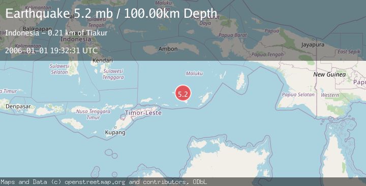
A 5.2 magnitude earthquake struck on KEPULAUAN BABAR, INDONESIA, at Sun, 01 Jan 2006 19:32:31 GMT. Depth: 100km. Reviewed by EMSC seismologists, this moderate quake occurred at a magnitude type of mb.
Magnitude
5.2
mb
Source
EMSC
Intensity
-
Agency Reports
1 Sources| Source | Magnitude | Depth | Time |
|---|---|---|---|
| EMSCPrimary | 5.2 | 100 km | 20 years ago |
Earthquake Details
AutomaticEvent IDemsc_EMSC_20060101_0000044
Tsunami PotentialNo
Magnitude Typemb
Nearest Places
- Damar Ridge36.5 km
- Watludan39.8 km
- Isu40.4 km
- Pulau-pulau Damar41.0 km
- Jafila41.1 km
Comments
Join the discussion about this event.
Latest Earthquakes
1.6Mag
Southern Alaska
Time12 hours ago
Depth48.58 km
SourceVYT (Automatic)
2.3Mag
Antofagasta, Chile
Time12 hours ago
Depth82.15 km
SourceVYT (Automatic)
2.1Mag
Southern Alaska
Time12 hours ago
Depth64.21 km
SourceVYT (Automatic)
2.5Mag
Central Alaska
Time12 hours ago
Depth312.99 km
SourceVYT (Automatic)
3.6Mag
Banda Sea
Time12 hours ago
Depth0.00 km
SourceVYT (Automatic)
Nearby Earthquakes
3.0Mag
Banda Sea
Time5 days ago
Depth177.86 km
SourceVYT (Automatic)
4.1Mag
Banda Sea
Time4 days ago
Depth184.81 km
SourceVYT (Automatic)
4.0Mag
KEPULAUAN BABAR, INDONESIA
Time5 years ago
Depth237.00 km
SourceDJA (Automatic)
5.0Mag
KEPULAUAN BABAR, INDONESIA
Time16 years ago
Depth142.00 km
SourceEMSC (Automatic)
5.0Mag
KEPULAUAN BABAR, INDONESIA
Time5 years ago
Depth117.00 km
SourceEMSC (Automatic)