Earthquake Banda Sea
Fri, 13 Feb 2026 23:54:49 GMT
Time5 days ago
Location
-7.1753, 129.4547
Depth
177.9 KM
Event Summary
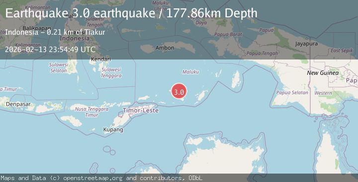
A 3.0 magnitude earthquake struck on Banda Sea, at Fri, 13 Feb 2026 23:54:49 GMT. Depth: 177.8564453125km. Reviewed by VYT seismologists, this minor quake occurred at a magnitude type of earthquake.
Magnitude
3.0
earthquake
Source
VYT
Intensity
-
Agency Reports
1 Sources| Source | Magnitude | Depth | Time |
|---|---|---|---|
| VYTPrimary | 3.0 | 178 km | 5 days ago |
Earthquake Details
AutomaticEvent IDvyt_1w68dxf5xwrha
Tsunami PotentialNo
Magnitude Typeearthquake
Nearest Places
- Damar Ridge38.4 km
- Watludan39.2 km
- Isu39.8 km
- Pulau-pulau Damar40.4 km
- Jafila40.7 km
Comments
Join the discussion about this event.
Latest Earthquakes
1.6Mag
Alaska Peninsula
Time4 hours ago
Depth15.63 km
SourceVYT (Automatic)
2.2Mag
FRANCE
Time4 hours ago
Depth5.00 km
SourceReNaSS (Automatic)
3.5Mag
Fox Islands, Aleutian Islands, Alaska
Time4 hours ago
Depth72.63 km
SourceVYT (Automatic)
2.9Mag
STRAIT OF GIBRALTAR
Time4 hours ago
Depth58.80 km
SourceIGN (Automatic)
1.8Mag
Kodiak Island region, Alaska
Time4 hours ago
Depth208.13 km
SourceVYT (Automatic)
Nearby Earthquakes
5.2Mag
KEPULAUAN BABAR, INDONESIA
Time20 years ago
Depth100.00 km
SourceEMSC (Automatic)
4.1Mag
Banda Sea
Time4 days ago
Depth184.81 km
SourceVYT (Automatic)
4.0Mag
KEPULAUAN BABAR, INDONESIA
Time5 years ago
Depth237.00 km
SourceDJA (Automatic)
5.0Mag
KEPULAUAN BABAR, INDONESIA
Time16 years ago
Depth142.00 km
SourceEMSC (Automatic)
5.4Mag
KEPULAUAN BABAR, INDONESIA
Time16 years ago
Depth167.00 km
SourceEMSC (Automatic)