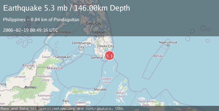
Earthquake MINDANAO, PHILIPPINES
Sun, 19 Feb 2006 00:49:16 GMT
Time20 years ago
Location
6.0100, 126.2000
Depth
146.0 KM
Event Summary
A 5.3 magnitude earthquake struck on MINDANAO, PHILIPPINES, at Sun, 19 Feb 2006 00:49:16 GMT. Depth: 146km. Reviewed by EMSC seismologists, this moderate quake occurred at a magnitude type of mb.
Magnitude
5.3
mb
Source
EMSC
Intensity
-
Agency Reports
1 Sources| Source | Magnitude | Depth | Time |
|---|---|---|---|
| EMSCPrimary | 5.3 | 146 km | 20 years ago |
Earthquake Details
AutomaticEvent IDemsc_EMSC_20060219_0000021
Tsunami PotentialNo
Magnitude Typemb
Nearest Places
- San Agustin Reef27.5 km
- San Agustin Lighthouse28.9 km
- Cape San Agustin29.1 km
- Talisay Point30.7 km
- Agustin 230.8 km
Comments
Join the discussion about this event.
Latest Earthquakes
3.2Mag
Croatia region
Time8 minutes ago
Depth10.00 km
SourceVYT (Automatic)
3.6Mag
Serbia
Time9 minutes ago
Depth688.35 km
SourceVYT (Automatic)
2.0Mag
AZORES ISLANDS REGION
Time9 minutes ago
Depth10.40 km
SourcePDA (Automatic)
3.1Mag
NORTH ISLAND OF NEW ZEALAND
Time10 minutes ago
Depth204.40 km
SourceGNS (Automatic)
2.2Mag
Andreanof Islands, Aleutian Islands, Alaska
Time13 minutes ago
Depth130.98 km
SourceVYT (Automatic)
Nearby Earthquakes
3.0Mag
MINDANAO, PHILIPPINES
Time1 year ago
Depth122.00 km
SourcePIVS (Automatic)
3.0Mag
MINDANAO, PHILIPPINES
Time5 years ago
Depth49.00 km
SourcePIVS (Automatic)
3.0Mag
MINDANAO, PHILIPPINES
Time6 months ago
Depth21.00 km
SourcePIVS (Automatic)
3.0Mag
MINDANAO, PHILIPPINES
Time2 months ago
Depth111.00 km
SourcePIVS (Automatic)
5.0Mag
MINDANAO, PHILIPPINES
Time14 years ago
Depth74.00 km
SourceEMSC (Automatic)