Earthquake BISMARCK SEA
Fri, 17 Mar 2006 13:48:12 GMT
Time19 years ago
Location
-4.8400, 149.7500
Depth
10.0 KM
Event Summary
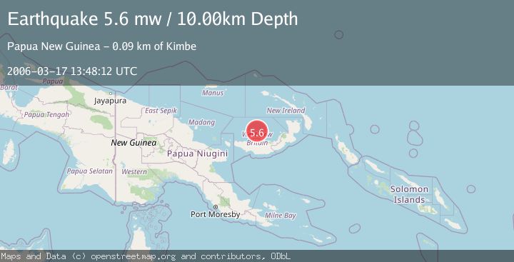
A 5.6 magnitude earthquake struck on BISMARCK SEA, at Fri, 17 Mar 2006 13:48:12 GMT. Depth: 10km. Reviewed by EMSC seismologists, this moderate quake occurred at a magnitude type of mw.
Magnitude
5.6
mw
Source
EMSC
Intensity
-
Agency Reports
1 Sources| Source | Magnitude | Depth | Time |
|---|---|---|---|
| EMSCPrimary | 5.6 | 10 km | 19 years ago |
Earthquake Details
AutomaticEvent IDemsc_EMSC_20060317_0000068
Tsunami PotentialNo
Magnitude Typemw
Nearest Places
- 26.4 km
- 27.3 km
- 27.5 km
- 28.1 km
- 3Lama28.3 km
Comments
Join the discussion about this event.
Latest Earthquakes
2.5Mag
Central Alaska
Time3 minutes ago
Depth115.60 km
SourceVYT (Automatic)
2.7Mag
Fox Islands, Aleutian Islands, Alaska
Time8 minutes ago
Depth40.41 km
SourceVYT (Automatic)
2.4Mag
Southeastern Alaska
Time20 minutes ago
Depth74.58 km
SourceVYT (Automatic)
2.6Mag
EASTERN TURKEY
Time21 minutes ago
Depth4.80 km
SourceKOERI (Automatic)
2.4Mag
ISLAND OF HAWAII, HAWAII
Time27 minutes ago
Depth1.30 km
SourceHV (Automatic)
Nearby Earthquakes
5.0Mag
BISMARCK SEA
Time10 years ago
Depth602.00 km
SourceEMSC (Automatic)
5.2Mag
BISMARCK SEA
Time19 years ago
Depth50.00 km
SourceEMSC (Automatic)
5.9Mag
BISMARCK SEA
Time9 years ago
Depth454.00 km
SourceEMSC (Automatic)
5.1Mag
NEW BRITAIN REGION, P.N.G.
Time1 year ago
Depth390.40 km
SourceEMSC (Automatic)
5.2Mag
NEW BRITAIN REGION, P.N.G.
Time16 years ago
Depth424.00 km
SourceEMSC (Automatic)