Earthquake SIMEULUE, INDONESIA
Fri, 17 Mar 2006 21:57:21 GMT
Time19 years ago
Location
2.2200, 96.6100
Depth
40.0 KM
Event Summary
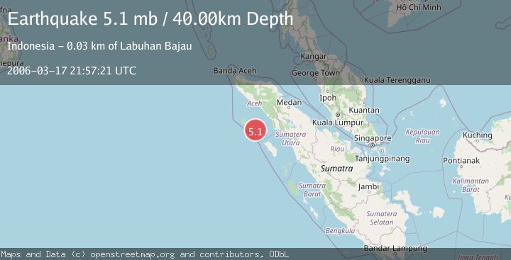
A 5.1 magnitude earthquake struck on SIMEULUE, INDONESIA, at Fri, 17 Mar 2006 21:57:21 GMT. Depth: 40km. Reviewed by EMSC seismologists, this moderate quake occurred at a magnitude type of mb.
Magnitude
5.1
mb
Source
EMSC
Intensity
-
Agency Reports
1 Sources| Source | Magnitude | Depth | Time |
|---|---|---|---|
| EMSCPrimary | 5.1 | 40 km | 19 years ago |
Earthquake Details
AutomaticEvent IDemsc_EMSC_20060317_0000077
Tsunami PotentialNo
Magnitude Typemb
Nearest Places
- Pulau Reusam4.8 km
- Pulau Lasia6.5 km
- Karang Suffolk9.8 km
- Gampong Labuhan Bajau14.7 km
- Pulau Babi14.9 km
Comments
Join the discussion about this event.
Latest Earthquakes
2.5Mag
Minahasa, Sulawesi, Indonesia
Time1 minute ago
Depth3.05 km
SourceVYT (Automatic)
2.6Mag
Antofagasta, Chile
Time1 minute ago
Depth125.12 km
SourceVYT (Automatic)
0.8Mag
7 km NW of The Geysers, CA
Time5 minutes ago
Depth1.32 km
SourceUSGS (Automatic)
2.5Mag
San Juan, Argentina
Time10 minutes ago
Depth363.53 km
SourceVYT (Automatic)
2.5Mag
Java, Indonesia
Time10 minutes ago
Depth115.43 km
SourceBMKG
Nearby Earthquakes
5.1Mag
SIMEULUE, INDONESIA
Time20 years ago
Depth40.00 km
SourceEMSC (Automatic)
5.2Mag
SIMEULUE, INDONESIA
Time19 years ago
Depth30.00 km
SourceEMSC (Automatic)
5.3Mag
SIMEULUE, INDONESIA
Time12 years ago
Depth6.00 km
SourceEMSC (Automatic)
5.0Mag
SIMEULUE, INDONESIA
Time18 years ago
Depth31.00 km
SourceEMSC (Automatic)
3.0Mag
SIMEULUE, INDONESIA
Time8 months ago
Depth11.00 km
SourceBMKG (Automatic)