Earthquake MOLUCCA SEA
Tue, 16 May 2006 14:16:20 GMT
Time19 years ago
Location
-0.1800, 125.2100
Depth
30.0 KM
Event Summary
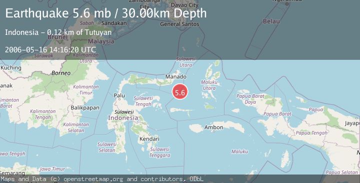
A 5.6 magnitude earthquake struck on MOLUCCA SEA, at Tue, 16 May 2006 14:16:20 GMT. Depth: 30km. Reviewed by EMSC seismologists, this moderate quake occurred at a magnitude type of mb.
Magnitude
5.6
mb
Source
EMSC
Intensity
-
Agency Reports
1 Sources| Source | Magnitude | Depth | Time |
|---|---|---|---|
| EMSCPrimary | 5.6 | 30 km | 19 years ago |
Earthquake Details
AutomaticEvent IDemsc_EMSC_20060516_0000027
Tsunami PotentialNo
Magnitude Typemb
Nearest Places
- Batu Mandi105.0 km
- Tanjung Flesko106.2 km
- Tanjung Palureoi106.7 km
- Pulau Lampu107.3 km
- Tanjung Payongan107.5 km
Comments
Join the discussion about this event.
Latest Earthquakes
2.0Mag
Central California
Time18 hours ago
Depth0.00 km
SourceVYT (Automatic)
0.7Mag
4 km NW of The Geysers, CA
Time18 hours ago
Depth3.05 km
SourceUSGS (Automatic)
2.7Mag
northern Colombia
Time18 hours ago
Depth73.00 km
SourceVYT (Automatic)
1.8Mag
2 km SW of Pāhala, Hawaii
Time18 hours ago
Depth29.79 km
SourceUSGS (Automatic)
1.0Mag
4 km W of Lake Henshaw, CA
Time18 hours ago
Depth12.06 km
SourceUSGS (Automatic)
Nearby Earthquakes
5.4Mag
MOLUCCA SEA
Time8 years ago
Depth60.00 km
SourceEMSC (Automatic)
5.5Mag
MOLUCCA SEA
Time8 years ago
Depth50.00 km
SourceEMSC (Automatic)
6.0Mag
MOLUCCA SEA
Time18 years ago
Depth50.00 km
SourceEMSC (Automatic)
5.1Mag
MOLUCCA SEA
Time4 years ago
Depth60.00 km
SourceEMSC (Automatic)
5.8Mag
MOLUCCA SEA
Time1 year ago
Depth39.70 km
SourceEMSC (Automatic)