Earthquake SOUTHERN SUMATRA, INDONESIA
Sun, 16 Sep 2007 11:37:39 GMT
Time18 years ago
Location
-2.7700, 101.2000
Depth
10.0 KM
Event Summary
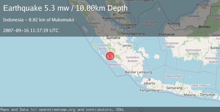
A 5.3 magnitude earthquake struck on SOUTHERN SUMATRA, INDONESIA, at Sun, 16 Sep 2007 11:37:39 GMT. Depth: 10km. Reviewed by EMSC seismologists, this moderate quake occurred at a magnitude type of mw.
Magnitude
5.3
mw
Source
EMSC
Intensity
-
Agency Reports
1 Sources| Source | Magnitude | Depth | Time |
|---|---|---|---|
| EMSCPrimary | 5.3 | 10 km | 18 years ago |
Earthquake Details
AutomaticEvent IDemsc_EMSC_20070916_0000068
Tsunami PotentialNo
Magnitude Typemw
Nearest Places
- Air Pelatun Gedang11.4 km
- Air Dikit11.5 km
- Sungai Pelakan11.9 km
- Airdikit12.0 km
- Air Bakal Kecil12.3 km
Comments
Join the discussion about this event.
Latest Earthquakes
1.1Mag
10 km WNW of The Geysers, CA
Time3 minutes ago
Depth2.07 km
SourceUSGS (Automatic)
1.6Mag
Southern Alaska
Time8 minutes ago
Depth0.12 km
SourceVYT (Automatic)
1.5Mag
Southeastern Alaska
Time11 minutes ago
Depth13.67 km
SourceVYT (Automatic)
4.8Mag
offshore Coquimbo, Chile
Time13 minutes ago
Depth0.00 km
SourceVYT (Automatic)
3.4Mag
Timor Region
Time13 minutes ago
Depth128.23 km
SourceBMKG
Nearby Earthquakes
6.1Mag
SOUTHERN SUMATRA, INDONESIA
Time18 years ago
Depth74.00 km
SourceEMSC (Automatic)
5.0Mag
SOUTHERN SUMATRA, INDONESIA
Time17 years ago
Depth54.00 km
SourceEMSC (Automatic)
5.8Mag
SOUTHERN SUMATRA, INDONESIA
Time14 years ago
Depth60.00 km
SourceEMSC (Automatic)
5.5Mag
SOUTHERN SUMATRA, INDONESIA
Time14 years ago
Depth60.00 km
SourceEMSC (Automatic)
5.5Mag
SOUTHERN SUMATRA, INDONESIA
Time18 years ago
Depth66.00 km
SourceEMSC (Automatic)