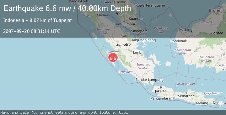
Earthquake SOUTHERN SUMATRA, INDONESIA
Thu, 20 Sep 2007 08:31:14 GMT
Time18 years ago
Location
-1.9800, 100.1900
Depth
40.0 KM
Event Summary
A 6.6 magnitude earthquake struck on SOUTHERN SUMATRA, INDONESIA, at Thu, 20 Sep 2007 08:31:14 GMT. Depth: 40km. Reviewed by EMSC seismologists, this strong quake occurred at a magnitude type of mw.
Magnitude
6.6
mw
Source
EMSC
Intensity
-
Agency Reports
1 Sources| Source | Magnitude | Depth | Time |
|---|---|---|---|
| EMSCPrimary | 6.6 | 40 km | 18 years ago |
Earthquake Details
AutomaticEvent IDemsc_EMSC_20070920_0000060
Tsunami PotentialNo
Magnitude Typemw
Nearest Places
- Selat Mentawai33.2 km
- Pulau Katangkatang43.2 km
- Pulau Karaba Besar49.6 km
- Pulau Baringin50.7 km
- Pulau Gosong53.6 km
Comments
Join the discussion about this event.
Latest Earthquakes
2.5Mag
Tarapaca, Chile
Time1 minute ago
Depth112.55 km
SourceVYT (Automatic)
2.2Mag
Tarapaca, Chile
Time7 minutes ago
Depth111.94 km
SourceVYT (Automatic)
1.9Mag
Central Alaska
Time7 minutes ago
Depth32.10 km
SourceVYT (Automatic)
3.4Mag
HAWAII REGION, HAWAII
Time8 minutes ago
Depth4.70 km
SourceHV (Automatic)
1.9Mag
STRAIT OF GIBRALTAR
Time11 minutes ago
Depth0.00 km
SourceIGN (Automatic)
Nearby Earthquakes
5.1Mag
KEP. MENTAWAI REGION, INDONESIA
Time19 years ago
Depth60.00 km
SourceEMSC (Automatic)
5.0Mag
SOUTHERN SUMATRA, INDONESIA
Time6 years ago
Depth60.00 km
SourceEMSC (Automatic)
5.1Mag
SOUTHERN SUMATRA, INDONESIA
Time5 years ago
Depth33.00 km
SourceEMSC (Automatic)
5.0Mag
SOUTHERN SUMATRA, INDONESIA
Time18 years ago
Depth77.00 km
SourceEMSC (Automatic)
5.4Mag
KEP. MENTAWAI REGION, INDONESIA
Time18 years ago
Depth30.00 km
SourceEMSC (Automatic)