Earthquake SOUTHERN SUMATRA, INDONESIA
Tue, 04 Aug 2020 23:51:08 GMT
Time5 years ago
Location
-1.8800, 100.2000
Depth
33.0 KM
Event Summary
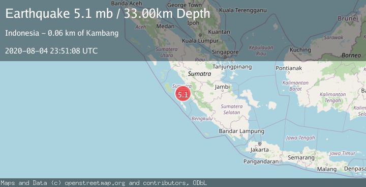
A 5.1 magnitude earthquake struck on SOUTHERN SUMATRA, INDONESIA, at Tue, 04 Aug 2020 23:51:08 GMT. Depth: 33km. Reviewed by EMSC seismologists, this moderate quake occurred at a magnitude type of mb.
Magnitude
5.1
mb
Source
EMSC
Intensity
-
Agency Reports
1 Sources| Source | Magnitude | Depth | Time |
|---|---|---|---|
| EMSCPrimary | 5.1 | 33 km | 5 years ago |
Earthquake Details
AutomaticEvent IDemsc_EMSC_20200804_0000191
Tsunami PotentialNo
Magnitude Typemb
Nearest Places
- Selat Mentawai26.5 km
- Pulau Katangkatang40.8 km
- Pulau Karaba Besar41.5 km
- Pulau Gosong47.4 km
- Pulau Karaba Kecil48.6 km
Comments
Join the discussion about this event.
Latest Earthquakes
1.2Mag
19 km NNE of Indio, CA
Time2 minutes ago
Depth4.01 km
SourceUSGS (Automatic)
2.5Mag
northwestern Russia
Time5 minutes ago
Depth0.00 km
SourceVYT (Automatic)
1.8Mag
54 km S of Whites City, New Mexico
Time7 minutes ago
Depth6.07 km
SourceUSGS (Automatic)
2.0Mag
Arizona
Time9 minutes ago
Depth8.18 km
SourceVYT (Automatic)
2.9Mag
Bosnia and Herzegovina
Time12 minutes ago
Depth268.68 km
SourceVYT (Automatic)
Nearby Earthquakes
5.0Mag
SOUTHERN SUMATRA, INDONESIA
Time6 years ago
Depth60.00 km
SourceEMSC (Automatic)
6.6Mag
SOUTHERN SUMATRA, INDONESIA
Time18 years ago
Depth40.00 km
SourceEMSC (Automatic)
5.2Mag
SOUTHERN SUMATRA, INDONESIA
Time19 years ago
Depth66.00 km
SourceEMSC (Automatic)
5.0Mag
SOUTHERN SUMATRA, INDONESIA
Time18 years ago
Depth77.00 km
SourceEMSC (Automatic)
5.1Mag
KEP. MENTAWAI REGION, INDONESIA
Time19 years ago
Depth60.00 km
SourceEMSC (Automatic)