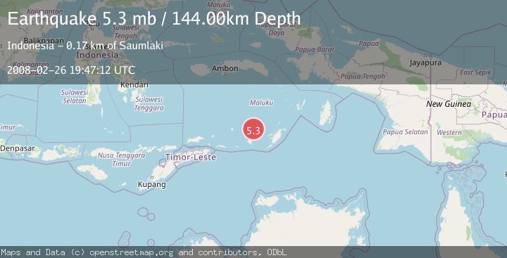
Earthquake KEPULAUAN BABAR, INDONESIA
Tue, 26 Feb 2008 19:47:12 GMT
Time17 years ago
Location
-7.1400, 129.9800
Depth
144.0 KM
Event Summary
A 5.3 magnitude earthquake struck on KEPULAUAN BABAR, INDONESIA, at Tue, 26 Feb 2008 19:47:12 GMT. Depth: 144km. Reviewed by EMSC seismologists, this moderate quake occurred at a magnitude type of mb.
Magnitude
5.3
mb
Source
EMSC
Intensity
-
Agency Reports
1 Sources| Source | Magnitude | Depth | Time |
|---|---|---|---|
| EMSCPrimary | 5.3 | 144 km | 17 years ago |
Earthquake Details
AutomaticEvent IDemsc_EMSC_20080226_0000089
Tsunami PotentialNo
Magnitude Typemb
Nearest Places
- Wakarlawen54.1 km
- Desa Lewah55.2 km
- Lewa55.6 km
- Desa Sinairusi56.3 km
- Desa Hertuti56.7 km
Comments
Join the discussion about this event.
Latest Earthquakes
1.2Mag
Central Alaska
Time15 hours ago
Depth43.82 km
SourceVYT (Automatic)
1.6Mag
58 km S of Whites City, New Mexico
Time15 hours ago
Depth4.17 km
SourceUSGS (Automatic)
1.3Mag
54 km WNW of Toyah, Texas
Time15 hours ago
Depth0.00 km
SourceUSGS (Automatic)
2.9Mag
Oruro, Bolivia
Time15 hours ago
Depth189.21 km
SourceVYT (Automatic)
3.4Mag
OFF COAST OF COSTA RICA
Time15 hours ago
Depth10.00 km
SourceINET (Automatic)
Nearby Earthquakes
3.3Mag
Banda Sea
Time4 days ago
Depth128.66 km
SourceVYT (Automatic)
5.0Mag
KEP. TANIMBAR REGION, INDONESIA
Time11 years ago
Depth143.00 km
SourceEMSC (Automatic)
5.0Mag
KEPULAUAN BABAR, INDONESIA
Time11 years ago
Depth140.00 km
SourceEMSC (Automatic)
5.2Mag
KEPULAUAN BABAR, INDONESIA
Time11 years ago
Depth132.00 km
SourceEMSC (Automatic)
7.6Mag
KEPULAUAN BABAR, INDONESIA
Time3 years ago
Depth104.00 km
SourceEMSC (Automatic)