Earthquake MOLUCCA SEA
Thu, 10 Jul 2008 06:29:51 GMT
Time17 years ago
Location
0.9100, 126.0600
Depth
60.0 KM
Event Summary
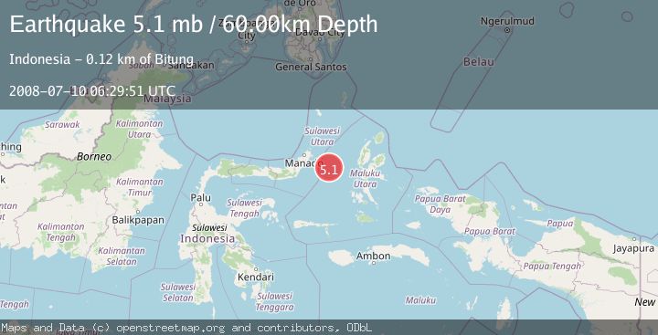
A 5.1 magnitude earthquake struck on MOLUCCA SEA, at Thu, 10 Jul 2008 06:29:51 GMT. Depth: 60km. Reviewed by EMSC seismologists, this moderate quake occurred at a magnitude type of mb.
Magnitude
5.1
mb
Source
EMSC
Intensity
-
Agency Reports
1 Sources| Source | Magnitude | Depth | Time |
|---|---|---|---|
| EMSCPrimary | 5.1 | 60 km | 17 years ago |
Earthquake Details
AutomaticEvent IDemsc_EMSC_20080710_0000046
Tsunami PotentialNo
Magnitude Typemb
Nearest Places
- Kelurahan Pantai Sagu11.3 km
- Pulau Tifore11.4 km
- Kelurahan Tifure11.4 km
- Pulau Gureda13.0 km
- Maluku Sea46.1 km
Comments
Join the discussion about this event.
Latest Earthquakes
2.2Mag
FRANCE
Time10 minutes ago
Depth5.00 km
SourceReNaSS (Automatic)
3.5Mag
Fox Islands, Aleutian Islands, Alaska
Time10 minutes ago
Depth72.63 km
SourceVYT (Automatic)
1.8Mag
Kodiak Island region, Alaska
Time12 minutes ago
Depth208.13 km
SourceVYT (Automatic)
2.6Mag
Armenia-Azerbaijan-Iran border region
Time14 minutes ago
Depth0.00 km
SourceVYT (Automatic)
1.9Mag
Southeastern Alaska
Time16 minutes ago
Depth0.00 km
SourceVYT (Automatic)
Nearby Earthquakes
3.1Mag
MOLUCCA SEA
Time1 month ago
Depth17.00 km
SourceBMKG (Automatic)
3.0Mag
MOLUCCA SEA
Time3 years ago
Depth25.00 km
SourceDJA (Automatic)
4.0Mag
MOLUCCA SEA
Time1 year ago
Depth10.00 km
SourceBMKG (Automatic)
3.0Mag
MOLUCCA SEA
Time8 months ago
Depth47.00 km
SourceBMKG (Automatic)
3.1Mag
Northern Molucca Sea
Time1 week ago
Depth10.00 km
SourceBMKG (Automatic)