Earthquake SAMOA ISLANDS REGION
Wed, 16 Jul 2008 08:11:07 GMT
Time17 years ago
Location
-16.6100, -172.9200
Depth
29.0 KM
Event Summary
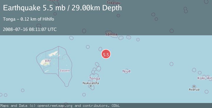
A 5.5 magnitude earthquake struck on SAMOA ISLANDS REGION, at Wed, 16 Jul 2008 08:11:07 GMT. Depth: 29km. Reviewed by EMSC seismologists, this moderate quake occurred at a magnitude type of mb.
Magnitude
5.5
mb
Source
EMSC
Intensity
-
Agency Reports
1 Sources| Source | Magnitude | Depth | Time |
|---|---|---|---|
| EMSCPrimary | 5.5 | 29 km | 17 years ago |
Earthquake Details
AutomaticEvent IDemsc_EMSC_20080716_0000040
Tsunami PotentialNo
Magnitude Typemb
Nearest Places
- 108.7 km
- 112.3 km
- 112.5 km
- 112.8 km
- 113.9 km
Comments
Join the discussion about this event.
Latest Earthquakes
1.9Mag
Southern California
Time6 minutes ago
Depth11.11 km
SourceVYT (Automatic)
1.9Mag
Sweden
Time8 minutes ago
Depth11.84 km
SourceVYT (Automatic)
0.8Mag
9 km NNW of Perryville, Alaska
Time10 minutes ago
Depth118.40 km
SourceUSGS (Automatic)
0.5Mag
Northern Territory, Australia
Time13 minutes ago
Depth5.00 km
SourceVYT (Automatic)
3.5Mag
OFF E. COAST OF N. ISLAND, N.Z.
Time16 minutes ago
Depth207.40 km
SourceGNS (Automatic)
Nearby Earthquakes
5.1Mag
SAMOA ISLANDS REGION
Time16 years ago
Depth2.00 km
SourceEMSC (Automatic)
5.3Mag
TONGA
Time2 years ago
Depth40.00 km
SourceEMSC (Automatic)
5.1Mag
SAMOA ISLANDS REGION
Time18 years ago
Depth33.00 km
SourceEMSC (Automatic)
5.3Mag
SAMOA ISLANDS REGION
Time20 years ago
Depth33.00 km
SourceEMSC (Automatic)
5.7Mag
TONGA
Time14 years ago
Depth6.00 km
SourceEMSC (Automatic)