Earthquake SOUTH OF SUMBAWA, INDONESIA
Tue, 27 Jan 2009 00:57:34 GMT
Time17 years ago
Location
-11.5600, 117.5500
Depth
10.0 KM
Event Summary
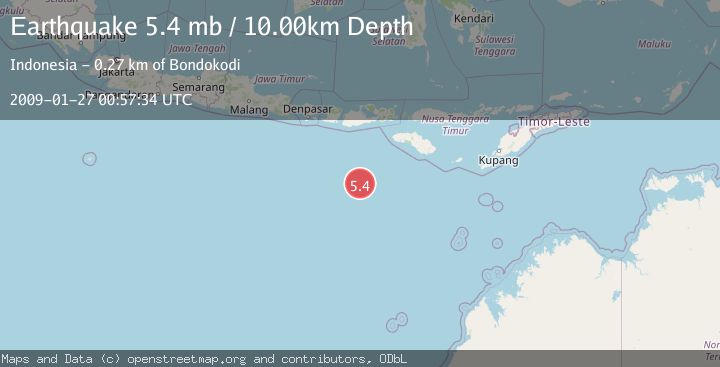
A 5.4 magnitude earthquake struck on SOUTH OF SUMBAWA, INDONESIA, at Tue, 27 Jan 2009 00:57:34 GMT. Depth: 10km. Reviewed by EMSC seismologists, this moderate quake occurred at a magnitude type of mb.
Magnitude
5.4
mb
Source
EMSC
Intensity
-
Agency Reports
1 Sources| Source | Magnitude | Depth | Time |
|---|---|---|---|
| EMSCPrimary | 5.4 | 10 km | 17 years ago |
Earthquake Details
AutomaticEvent IDemsc_EMSC_20090127_0000041
Tsunami PotentialNo
Magnitude Typemb
Nearest Places
- Corona Bank150.7 km
- Lombok Basin256.0 km
- Tanjung Karosso263.9 km
- Tanjung Waibuku264.5 km
- Loko Waikataku264.6 km
Comments
Join the discussion about this event.
Latest Earthquakes
1.6Mag
41 km NW of Toyah, Texas
Time14 hours ago
Depth3.46 km
SourceUSGS (Automatic)
0.7Mag
6 km WNW of Cobb, CA
Time14 hours ago
Depth-0.59 km
SourceUSGS (Automatic)
1.0Mag
Southern Alaska
Time14 hours ago
Depth0.12 km
SourceVYT (Automatic)
2.1Mag
Sumbawa Region, Indonesia
Time14 hours ago
Depth21.86 km
SourceBMKG
4.0Mag
northwest of Australia
Time14 hours ago
Depth91.80 km
SourceVYT (Automatic)
Nearby Earthquakes
4.0Mag
SOUTH OF SUMBAWA, INDONESIA
Time4 years ago
Depth10.00 km
SourceDJA (Automatic)
4.0Mag
SOUTH OF SUMBAWA, INDONESIA
Time6 years ago
Depth10.00 km
SourceDJA (Automatic)
4.0Mag
SOUTH OF SUMBAWA, INDONESIA
Time6 years ago
Depth16.00 km
SourceDJA (Automatic)
4.0Mag
SOUTH OF SUMBAWA, INDONESIA
Time5 years ago
Depth10.00 km
SourceNEIC (Automatic)
5.0Mag
SOUTH OF SUMBAWA, INDONESIA
Time12 years ago
Depth10.00 km
SourceEMSC (Automatic)