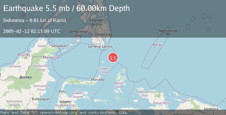
Earthquake KEPULAUAN TALAUD, INDONESIA
Thu, 12 Feb 2009 02:15:09 GMT
Time17 years ago
Location
4.1800, 126.9800
Depth
60.0 KM
Event Summary
A 5.5 magnitude earthquake struck on KEPULAUAN TALAUD, INDONESIA, at Thu, 12 Feb 2009 02:15:09 GMT. Depth: 60km. Reviewed by EMSC seismologists, this moderate quake occurred at a magnitude type of mb.
Magnitude
5.5
mb
Source
EMSC
Intensity
-
Agency Reports
1 Sources| Source | Magnitude | Depth | Time |
|---|---|---|---|
| EMSCPrimary | 5.5 | 50 km | 17 years ago |
Earthquake Details
AutomaticEvent IDemsc_EMSC_20090212_0000076
Tsunami PotentialNo
Magnitude Typemb
Nearest Places
- Tanjung Toaduwata12.6 km
- Tabang12.9 km
- Tanjung Bitunuris12.9 km
- Desa Rainis Batupenga13.5 km
- Rainis13.9 km
Comments
Join the discussion about this event.
Latest Earthquakes
2.4Mag
West Papua Region, Indonesia
Time9 minutes ago
Depth10.00 km
SourceBMKG
3.3Mag
Talaud Islands, Indonesia
Time10 minutes ago
Depth10.00 km
SourceBMKG
1.1Mag
4 km NW of The Geysers, CA
Time10 minutes ago
Depth3.39 km
SourceUSGS (Automatic)
1.0Mag
33 km WSW of Ackerly, Texas
Time10 minutes ago
Depth4.44 km
SourceUSGS (Automatic)
2.8Mag
Antofagasta, Chile
Time14 minutes ago
Depth0.00 km
SourceVYT (Automatic)
Nearby Earthquakes
3.0Mag
KEPULAUAN TALAUD, INDONESIA
Time2 years ago
Depth74.00 km
SourceDJA (Automatic)
4.0Mag
KEPULAUAN TALAUD, INDONESIA
Time1 year ago
Depth10.00 km
SourceBMKG (Automatic)
6.1Mag
KEPULAUAN TALAUD, INDONESIA
Time17 years ago
Depth60.00 km
SourceEMSC (Automatic)
3.0Mag
KEPULAUAN TALAUD, INDONESIA
Time8 months ago
Depth9.00 km
SourcePIVS (Automatic)
5.1Mag
KEPULAUAN TALAUD, INDONESIA
Time13 years ago
Depth70.00 km
SourceEMSC (Automatic)