Earthquake WEST OF GIBRALTAR
Tue, 17 Feb 2009 23:55:03 GMT
Time17 years ago
Location
36.7635, -9.7468
Depth
15.0 KM
Event Summary
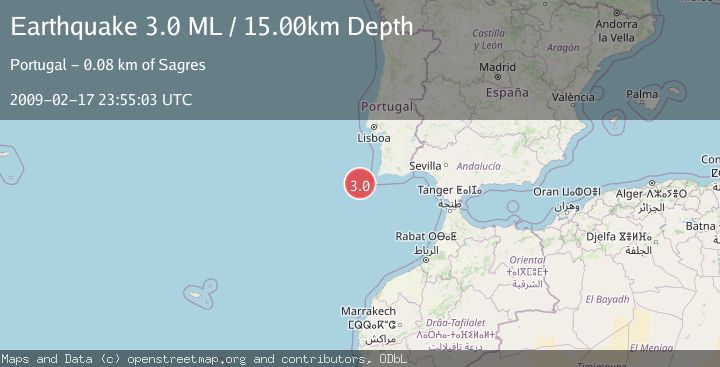
A 3.0 magnitude earthquake struck on WEST OF GIBRALTAR, at Tue, 17 Feb 2009 23:55:03 GMT. Depth: 15km. Reviewed by EMSC seismologists, this minor quake occurred at a magnitude type of ML.
Magnitude
3.0
ML
Source
EMSC
Intensity
-
Agency Reports
1 Sources| Source | Magnitude | Depth | Time |
|---|---|---|---|
| EMSCPrimary | 3.0 | 15 km | 17 years ago |
Earthquake Details
AutomaticEvent IDemsc_EMSC_20090217_0000165
Tsunami PotentialNo
Magnitude TypeML
Nearest Places
- São Vicente Canyon36.0 km
- Carlos Ribeiro Gap40.4 km
- Lagos Canyon64.5 km
- Cabo de São Vicente72.6 km
- Cabo de São Vicente Lighthouse72.7 km
Comments
Join the discussion about this event.
Latest Earthquakes
2.0Mag
Southern Alaska
Time7 minutes ago
Depth26.61 km
SourceVYT (Automatic)
2.8Mag
Central Alaska
Time11 minutes ago
Depth292.36 km
SourceVYT (Automatic)
1.0Mag
12 km ESE of Anza, CA
Time16 minutes ago
Depth18.49 km
SourceUSGS (Automatic)
3.2Mag
Molucca Sea
Time17 minutes ago
Depth0.12 km
SourceVYT (Automatic)
1.0Mag
33 km SE of Minto, Alaska
Time19 minutes ago
Depth8.60 km
SourceUSGS (Automatic)
Nearby Earthquakes
3.0Mag
WEST OF GIBRALTAR
Time7 years ago
Depth30.00 km
SourceEMSC (Automatic)
3.0Mag
WEST OF GIBRALTAR
Time17 years ago
Depth10.00 km
SourceEMSC (Automatic)
3.0Mag
WEST OF GIBRALTAR
Time16 years ago
Depth10.00 km
SourceEMSC (Automatic)
3.0Mag
WEST OF GIBRALTAR
Time19 years ago
Depth25.00 km
SourceEMSC (Automatic)
3.0Mag
WEST OF GIBRALTAR
Time16 years ago
Depth20.00 km
SourceEMSC (Automatic)