Earthquake KEPULAUAN TALAUD, INDONESIA
Thu, 26 Feb 2009 16:15:56 GMT
Time16 years ago
Location
3.6500, 126.7800
Depth
80.0 KM
Event Summary
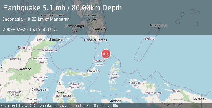
A 5.1 magnitude earthquake struck on KEPULAUAN TALAUD, INDONESIA, at Thu, 26 Feb 2009 16:15:56 GMT. Depth: 80km. Reviewed by EMSC seismologists, this moderate quake occurred at a magnitude type of mb.
Magnitude
5.1
mb
Source
EMSC
Intensity
-
Agency Reports
1 Sources| Source | Magnitude | Depth | Time |
|---|---|---|---|
| EMSCPrimary | 5.1 | 80 km | 16 years ago |
Earthquake Details
AutomaticEvent IDemsc_EMSC_20090226_0000061
Tsunami PotentialNo
Magnitude Typemb
Nearest Places
- Pulau Napumbalu9.2 km
- Tanjung Pallo9.9 km
- Taduwale10.6 km
- Tanjung Panii10.7 km
- Peret10.8 km
Comments
Join the discussion about this event.
Latest Earthquakes
1.9Mag
northern Alaska
Time5 minutes ago
Depth10.00 km
SourceVYT (Automatic)
0.9Mag
Washington
Time5 minutes ago
Depth0.00 km
SourceVYT (Automatic)
3.1Mag
Savu Sea
Time9 minutes ago
Depth119.50 km
SourceBMKG
1.2Mag
Southeastern Alaska
Time12 minutes ago
Depth0.00 km
SourceVYT (Automatic)
3.4Mag
Talaud Islands, Indonesia
Time12 minutes ago
Depth15.68 km
SourceBMKG
Nearby Earthquakes
5.1Mag
KEPULAUAN TALAUD, INDONESIA
Time13 years ago
Depth40.00 km
SourceEMSC (Automatic)
5.4Mag
KEPULAUAN TALAUD, INDONESIA
Time4 years ago
Depth44.00 km
SourceEMSC (Automatic)
5.1Mag
KEPULAUAN TALAUD, INDONESIA
Time17 years ago
Depth60.00 km
SourceEMSC (Automatic)
5.0Mag
KEPULAUAN TALAUD, INDONESIA
Time16 years ago
Depth60.00 km
SourceEMSC (Automatic)
5.4Mag
KEPULAUAN TALAUD, INDONESIA
Time4 years ago
Depth21.00 km
SourceEMSC (Automatic)