Earthquake SOUTH OF KERMADEC ISLANDS
Wed, 18 Mar 2009 16:23:49 GMT
Time16 years ago
Location
-33.1900, 179.6300
Depth
244.0 KM
Event Summary
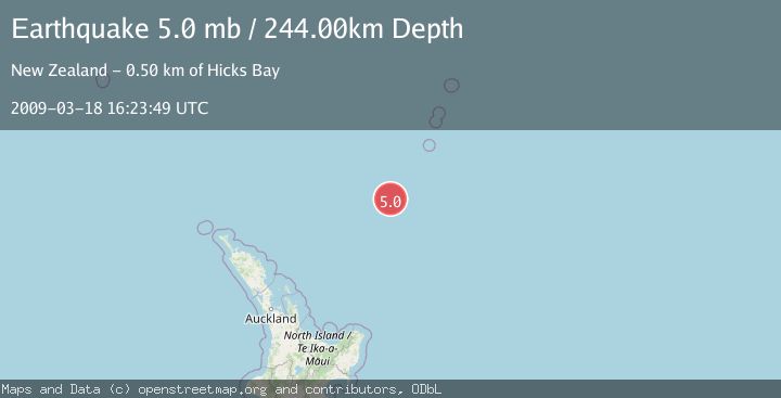
A 5.0 magnitude earthquake struck on SOUTH OF KERMADEC ISLANDS, at Wed, 18 Mar 2009 16:23:49 GMT. Depth: 244km. Reviewed by EMSC seismologists, this moderate quake occurred at a magnitude type of mb.
Magnitude
5.0
mb
Source
EMSC
Intensity
-
Agency Reports
1 Sources| Source | Magnitude | Depth | Time |
|---|---|---|---|
| EMSCPrimary | 5.0 | 244 km | 16 years ago |
Earthquake Details
AutomaticEvent IDemsc_EMSC_20090318_0000074
Tsunami PotentialNo
Magnitude Typemb
Nearest Places
- Kuiwai Seamount41.9 km
- Ngātoroirangi Seamount62.6 km
- Haungaroa Seamount93.4 km
- Oliver Knoll109.9 km
- Speight Knoll115.3 km
Comments
Join the discussion about this event.
Latest Earthquakes
2.1Mag
Tarapaca, Chile
Time3 minutes ago
Depth0.00 km
SourceVYT (Automatic)
2.1Mag
near the coast of Tarapaca, Chile
Time5 minutes ago
Depth24.41 km
SourceVYT (Automatic)
2.0Mag
EASTERN TURKEY
Time9 minutes ago
Depth5.40 km
SourceKOERI (Automatic)
2.8Mag
Northern Sumatra, Indonesia
Time18 minutes ago
Depth5.00 km
SourceBMKG
2.0Mag
Tarapaca, Chile
Time18 minutes ago
Depth0.00 km
SourceVYT (Automatic)
Nearby Earthquakes
5.4Mag
SOUTH OF KERMADEC ISLANDS
Time9 years ago
Depth253.00 km
SourceEMSC (Automatic)
4.0Mag
SOUTH OF KERMADEC ISLANDS
Time3 years ago
Depth335.00 km
SourceGNS (Automatic)
4.0Mag
SOUTH OF KERMADEC ISLANDS
Time4 years ago
Depth100.00 km
SourceGNS (Automatic)
4.0Mag
SOUTH OF KERMADEC ISLANDS
Time3 years ago
Depth100.00 km
SourceGNS (Automatic)
4.0Mag
SOUTH OF KERMADEC ISLANDS
Time5 years ago
Depth410.00 km
SourceGNS (Automatic)