Earthquake SOUTHERN SUMATRA, INDONESIA
Sun, 26 Jul 2009 23:10:27 GMT
Time16 years ago
Location
-4.7500, 102.9800
Depth
70.0 KM
Event Summary
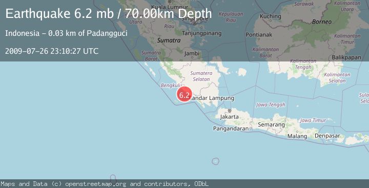
A 6.2 magnitude earthquake struck on SOUTHERN SUMATRA, INDONESIA, at Sun, 26 Jul 2009 23:10:27 GMT. Depth: 70km. Reviewed by EMSC seismologists, this strong quake occurred at a magnitude type of mb.
Magnitude
6.2
mb
Source
EMSC
Intensity
-
Agency Reports
1 Sources| Source | Magnitude | Depth | Time |
|---|---|---|---|
| EMSCPrimary | 6.2 | 70 km | 16 years ago |
Earthquake Details
AutomaticEvent IDemsc_EMSC_20090726_0000141
Tsunami PotentialNo
Magnitude Typemb
Nearest Places
- Air Sulau23.5 km
- Desa Suka Jaya24.1 km
- Air Padangguci24.3 km
- Air Sulau Kanan24.3 km
- Beriang25.2 km
Comments
Join the discussion about this event.
Latest Earthquakes
2.0Mag
Kenai Peninsula, Alaska
Time1 minute ago
Depth72.27 km
SourceVYT (Automatic)
2.0Mag
Central Alaska
Time4 minutes ago
Depth216.92 km
SourceVYT (Automatic)
1.8Mag
Region Metropolitana, Chile
Time8 minutes ago
Depth14.89 km
SourceVYT (Automatic)
4.9Mag
Kepulauan Aru region, Indonesia
Time9 minutes ago
Depth0.00 km
SourceVYT (Automatic)
2.5Mag
Poland
Time9 minutes ago
Depth0.24 km
SourceVYT (Automatic)
Nearby Earthquakes
5.4Mag
SOUTHERN SUMATRA, INDONESIA
Time16 years ago
Depth60.00 km
SourceEMSC (Automatic)
5.4Mag
SOUTHERN SUMATRA, INDONESIA
Time20 years ago
Depth70.00 km
SourceEMSC (Automatic)
5.5Mag
SOUTHERN SUMATRA, INDONESIA
Time2 years ago
Depth66.00 km
SourceEMSC (Automatic)
5.5Mag
SOUTHERN SUMATRA, INDONESIA
Time2 years ago
Depth54.00 km
SourceEMSC (Automatic)
5.5Mag
SOUTHERN SUMATRA, INDONESIA
Time13 years ago
Depth74.00 km
SourceEMSC (Automatic)