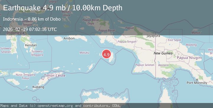
Earthquake Kepulauan Aru region, Indonesia
Thu, 19 Feb 2026 07:02:31 GMT
Time2 hours ago
Location
-5.7464, 132.9384
Depth
37.6 KM
Event Summary
A 3.6 magnitude earthquake struck on Kepulauan Aru region, Indonesia, at Thu, 19 Feb 2026 07:02:31 GMT. Depth: 37.59765625km. Reviewed by VYT seismologists, this minor quake occurred at a magnitude type of earthquake.
Magnitude
3.6
earthquake
Source
VYT
Intensity
-
Agency Reports
1 Sources| Source | Magnitude | Depth | Time |
|---|---|---|---|
| VYTPrimary | 3.6 | 38 km | 2 hours ago |
Earthquake Details
AutomaticEvent IDvyt_1bt79lv5kvox4
Tsunami PotentialNo
Magnitude Typeearthquake
Nearest Places
- Desa Mataholat0.6 km
- Mataholat1.2 km
- Watuar2.5 km
- Ohoiwait2.5 km
- Desa Ohoiwait2.7 km
Comments
Join the discussion about this event.
Latest Earthquakes
2.5Mag
Poland
Time2 hours ago
Depth0.24 km
SourceVYT (Automatic)
1.2Mag
7 km SE of Winchester, CA
Time2 hours ago
Depth11.41 km
SourceUSGS (Automatic)
2.1Mag
Region Metropolitana, Chile
Time2 hours ago
Depth10.00 km
SourceVYT (Automatic)
1.1Mag
7 km W of Cobb, CA
Time2 hours ago
Depth1.87 km
SourceUSGS (Automatic)
2.6Mag
Near North Coast of West Papua
Time2 hours ago
Depth33.87 km
SourceBMKG
Nearby Earthquakes
3.8Mag
KEPULAUAN ARU REGION, INDONESIA
Time1 month ago
Depth74.00 km
SourceBMKG (Automatic)
3.5Mag
KEP. TANIMBAR REGION, INDONESIA
Time2 days ago
Depth61.00 km
SourceBMKG (Automatic)
5.4Mag
KEP. TANIMBAR REGION, INDONESIA
Time7 years ago
Depth30.00 km
SourceEMSC (Automatic)
5.4Mag
KEPULAUAN KAI, INDONESIA
Time20 years ago
Depth10.00 km
SourceEMSC (Automatic)
3.5Mag
Tanimbar Islands Region, Indonesia
Time1 week ago
Depth63.97 km
SourceBMKG (Automatic)