Earthquake KEP. MENTAWAI REGION, INDONESIA
Mon, 17 Aug 2009 14:14:11 GMT
Time16 years ago
Location
-1.3900, 99.4800
Depth
40.0 KM
Event Summary
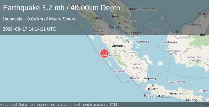
A 5.2 magnitude earthquake struck on KEP. MENTAWAI REGION, INDONESIA, at Mon, 17 Aug 2009 14:14:11 GMT. Depth: 40km. Reviewed by EMSC seismologists, this moderate quake occurred at a magnitude type of mb.
Magnitude
5.2
mb
Source
EMSC
Intensity
-
Agency Reports
1 Sources| Source | Magnitude | Depth | Time |
|---|---|---|---|
| EMSCPrimary | 5.2 | 30 km | 16 years ago |
Earthquake Details
AutomaticEvent IDemsc_EMSC_20090817_0000068
Tsunami PotentialNo
Magnitude Typemb
Nearest Places
- Mentawai Basin12.4 km
- Pulau Kasik32.8 km
- Tanjung Sikabai33.4 km
- Tanjung Mambaset34.5 km
- Tanjung Sinailakku34.6 km
Comments
Join the discussion about this event.
Latest Earthquakes
2.5Mag
Bering Strait
Time2 minutes ago
Depth200.07 km
SourceVYT (Automatic)
2.3Mag
Sumbawa Region, Indonesia
Time3 minutes ago
Depth10.00 km
SourceBMKG
1.6Mag
13 km ENE of Falls City, Texas
Time13 minutes ago
Depth7.18 km
SourceUSGS (Automatic)
1.5Mag
EASTERN TURKEY
Time16 minutes ago
Depth7.00 km
SourceAFAD (Automatic)
1.3Mag
5 km S of Cabazon, CA
Time16 minutes ago
Depth5.80 km
SourceUSGS (Automatic)
Nearby Earthquakes
5.0Mag
KEP. MENTAWAI REGION, INDONESIA
Time16 years ago
Depth40.00 km
SourceEMSC (Automatic)
5.5Mag
KEP. MENTAWAI REGION, INDONESIA
Time16 years ago
Depth10.00 km
SourceEMSC (Automatic)
5.0Mag
KEP. MENTAWAI REGION, INDONESIA
Time16 years ago
Depth40.00 km
SourceEMSC (Automatic)
5.0Mag
KEP. MENTAWAI REGION, INDONESIA
Time16 years ago
Depth51.00 km
SourceEMSC (Automatic)
5.2Mag
KEP. MENTAWAI REGION, INDONESIA
Time16 years ago
Depth40.00 km
SourceEMSC (Automatic)