Earthquake MOLUCCA SEA
Thu, 29 Oct 2009 05:21:21 GMT
Time16 years ago
Location
1.3000, 126.3000
Depth
60.0 KM
Event Summary
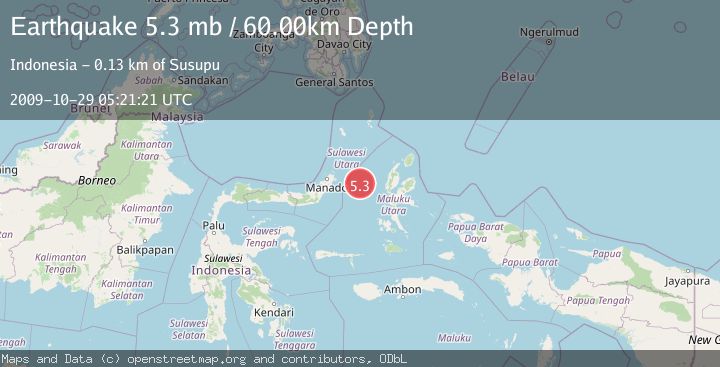
A 5.3 magnitude earthquake struck on MOLUCCA SEA, at Thu, 29 Oct 2009 05:21:21 GMT. Depth: 60km. Reviewed by EMSC seismologists, this moderate quake occurred at a magnitude type of mb.
Magnitude
5.3
mb
Source
EMSC
Intensity
-
Agency Reports
1 Sources| Source | Magnitude | Depth | Time |
|---|---|---|---|
| EMSCPrimary | 5.3 | 60 km | 16 years ago |
Earthquake Details
AutomaticEvent IDemsc_EMSC_20091029_0000006
Tsunami PotentialNo
Magnitude Typemb
Nearest Places
- Kelurahan Perum Bersatu7.2 km
- Pasirputih7.3 km
- Kelurahan Mayau9.3 km
- Kelurahan Lelewi9.3 km
- Kecamatan Pulau Batang Dua9.9 km
Comments
Join the discussion about this event.
Latest Earthquakes
3.2Mag
Croatia region
Time7 minutes ago
Depth10.00 km
SourceVYT (Automatic)
3.6Mag
Serbia
Time7 minutes ago
Depth688.35 km
SourceVYT (Automatic)
2.0Mag
AZORES ISLANDS REGION
Time8 minutes ago
Depth10.40 km
SourcePDA (Automatic)
3.1Mag
NORTH ISLAND OF NEW ZEALAND
Time8 minutes ago
Depth204.40 km
SourceGNS (Automatic)
2.2Mag
Andreanof Islands, Aleutian Islands, Alaska
Time12 minutes ago
Depth130.98 km
SourceVYT (Automatic)
Nearby Earthquakes
5.6Mag
MOLUCCA SEA
Time19 years ago
Depth10.00 km
SourceEMSC (Automatic)
5.2Mag
MOLUCCA SEA
Time18 years ago
Depth30.00 km
SourceEMSC (Automatic)
3.0Mag
MOLUCCA SEA
Time3 years ago
Depth10.00 km
SourceDJA (Automatic)
4.0Mag
MOLUCCA SEA
Time2 years ago
Depth26.00 km
SourceBMKG (Automatic)
5.4Mag
MOLUCCA SEA
Time19 years ago
Depth30.00 km
SourceEMSC (Automatic)