Earthquake BANDA SEA
Mon, 18 Jan 2010 12:19:13 GMT
Time16 years ago
Location
-6.3100, 130.6600
Depth
128.0 KM
Event Summary
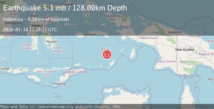
A 5.1 magnitude earthquake struck on BANDA SEA, at Mon, 18 Jan 2010 12:19:13 GMT. Depth: 128km. Reviewed by EMSC seismologists, this moderate quake occurred at a magnitude type of mb.
Magnitude
5.1
mb
Source
EMSC
Intensity
-
Agency Reports
1 Sources| Source | Magnitude | Depth | Time |
|---|---|---|---|
| EMSCPrimary | 5.1 | 128 km | 16 years ago |
Earthquake Details
AutomaticEvent IDemsc_EMSC_20100118_0000022
Tsunami PotentialNo
Magnitude Typemb
Nearest Places
- Kepulauan Selatan Daya49.9 km
- Weber Basin51.0 km
- Waru69.7 km
- Pulau Serua71.2 km
- Lesluru72.2 km
Comments
Join the discussion about this event.
Latest Earthquakes
2.1Mag
Antofagasta, Chile
Time8 hours ago
Depth20.26 km
SourceVYT (Automatic)
1.5Mag
48 km WNW of Tatitlek, Alaska
Time9 hours ago
Depth5.00 km
SourceUSGS (Automatic)
2.7Mag
Unimak Island region, Alaska
Time9 hours ago
Depth0.00 km
SourceVYT (Automatic)
1.6Mag
Kenai Peninsula, Alaska
Time9 hours ago
Depth78.98 km
SourceVYT (Automatic)
2.3Mag
Region Metropolitana, Chile
Time9 hours ago
Depth19.17 km
SourceVYT (Automatic)
Nearby Earthquakes
4.0Mag
BANDA SEA
Time3 years ago
Depth109.00 km
SourceDJA (Automatic)
3.3Mag
Banda Sea
Time6 days ago
Depth244.75 km
SourceVYT (Automatic)
5.0Mag
BANDA SEA
Time18 years ago
Depth145.00 km
SourceEMSC (Automatic)
5.0Mag
BANDA SEA
Time15 years ago
Depth137.00 km
SourceEMSC (Automatic)
5.5Mag
Banda Sea
Time3 weeks ago
Depth155.21 km
SourceBMKG (Automatic)