Earthquake SUNDA STRAIT, INDONESIA
Fri, 09 Jul 2010 10:13:37 GMT
Time15 years ago
Location
-6.1100, 105.4200
Depth
53.0 KM
Event Summary
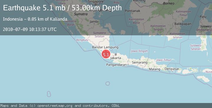
A 5.1 magnitude earthquake struck on SUNDA STRAIT, INDONESIA, at Fri, 09 Jul 2010 10:13:37 GMT. Depth: 53km. Reviewed by EMSC seismologists, this moderate quake occurred at a magnitude type of mb.
Magnitude
5.1
mb
Source
EMSC
Intensity
-
Agency Reports
1 Sources| Source | Magnitude | Depth | Time |
|---|---|---|---|
| EMSCPrimary | 5.1 | 53 km | 15 years ago |
Earthquake Details
AutomaticEvent IDemsc_EMSC_20100709_0000022
Tsunami PotentialNo
Magnitude Typemb
Nearest Places
- Anak Krakatau0.8 km
- Pulau-pulau Krakatau0.8 km
- Krakatoa1.0 km
- Pulau Anak Krakatau1.1 km
- Batu Parang1.9 km
Comments
Join the discussion about this event.
Latest Earthquakes
3.8Mag
Molucca Sea
Time2 minutes ago
Depth99.49 km
SourceVYT (Automatic)
2.8Mag
Minahasa, Sulawesi, Indonesia
Time5 minutes ago
Depth3.17 km
SourceVYT (Automatic)
2.6Mag
Antofagasta, Chile
Time6 minutes ago
Depth125.12 km
SourceVYT (Automatic)
1.3Mag
11 km WSW of Stanton, Texas
Time7 minutes ago
Depth4.19 km
SourceUSGS (Automatic)
0.8Mag
7 km NW of The Geysers, CA
Time10 minutes ago
Depth1.32 km
SourceUSGS (Automatic)
Nearby Earthquakes
3.0Mag
SUNDA STRAIT, INDONESIA
Time3 years ago
Depth10.00 km
SourceDJA (Automatic)
5.0Mag
SUNDA STRAIT, INDONESIA
Time8 years ago
Depth60.00 km
SourceEMSC (Automatic)
5.2Mag
SUNDA STRAIT, INDONESIA
Time7 years ago
Depth60.00 km
SourceEMSC (Automatic)
5.2Mag
SUNDA STRAIT, INDONESIA
Time9 years ago
Depth60.00 km
SourceEMSC (Automatic)
4.0Mag
SUNDA STRAIT, INDONESIA
Time8 months ago
Depth74.00 km
SourceBMKG (Automatic)