Earthquake KERMADEC ISLANDS REGION
Sat, 10 Jul 2010 23:04:23 GMT
Time15 years ago
Location
-30.6200, -179.9100
Depth
407.0 KM
Event Summary
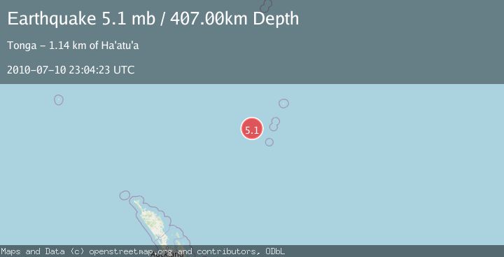
A 5.1 magnitude earthquake struck on KERMADEC ISLANDS REGION, at Sat, 10 Jul 2010 23:04:23 GMT. Depth: 407km. Reviewed by EMSC seismologists, this moderate quake occurred at a magnitude type of mb.
Magnitude
5.1
mb
Source
EMSC
Intensity
-
Agency Reports
1 Sources| Source | Magnitude | Depth | Time |
|---|---|---|---|
| EMSCPrimary | 5.1 | 407 km | 15 years ago |
Earthquake Details
AutomaticEvent IDemsc_EMSC_20100710_0000046
Tsunami PotentialNo
Magnitude Typemb
Nearest Places
- Colville Ridge69.5 km
- Havre Seamount97.8 km
- Havre Trough105.4 km
- Havre Rock118.8 km
- Cheeseman Island128.8 km
Comments
Join the discussion about this event.
Latest Earthquakes
2.7Mag
Kenai Peninsula, Alaska
Time4 minutes ago
Depth37.60 km
SourceVYT (Automatic)
1.1Mag
Washington
Time5 minutes ago
Depth0.00 km
SourceVYT (Automatic)
3.2Mag
Region Metropolitana, Chile
Time6 minutes ago
Depth99.73 km
SourceVYT (Automatic)
2.4Mag
Sumba Region, Indonesia
Time10 minutes ago
Depth17.38 km
SourceBMKG
2.1Mag
West Papua Region, Indonesia
Time11 minutes ago
Depth10.00 km
SourceBMKG
Nearby Earthquakes
4.0Mag
KERMADEC ISLANDS REGION
Time3 years ago
Depth203.00 km
SourceNEIC (Automatic)
5.7Mag
KERMADEC ISLANDS REGION
Time2 years ago
Depth435.00 km
SourceEMSC (Automatic)
5.2Mag
KERMADEC ISLANDS REGION
Time5 years ago
Depth338.00 km
SourceEMSC (Automatic)
5.0Mag
KERMADEC ISLANDS REGION
Time2 years ago
Depth590.40 km
SourceEMSC (Automatic)
6.2Mag
KERMADEC ISLANDS REGION
Time18 years ago
Depth400.00 km
SourceEMSC (Automatic)