Earthquake HALMAHERA, INDONESIA
Fri, 29 Oct 2010 06:19:21 GMT
Time15 years ago
Location
2.8100, 128.3700
Depth
68.0 KM
Event Summary
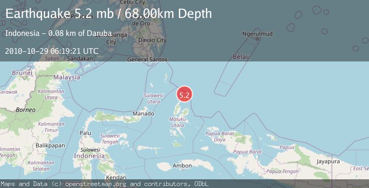
A 5.2 magnitude earthquake struck on HALMAHERA, INDONESIA, at Fri, 29 Oct 2010 06:19:21 GMT. Depth: 68km. Reviewed by EMSC seismologists, this moderate quake occurred at a magnitude type of mb.
Magnitude
5.2
mb
Source
EMSC
Intensity
-
Agency Reports
1 Sources| Source | Magnitude | Depth | Time |
|---|---|---|---|
| EMSCPrimary | 5.2 | 68 km | 15 years ago |
Earthquake Details
AutomaticEvent IDemsc_EMSC_20101029_0000013
Tsunami PotentialNo
Magnitude Typemb
Nearest Places
- Tanjung Padangi26.1 km
- Tanjung Berri Berri27.3 km
- Padangi27.5 km
- Bere Bere28.3 km
- Kakaibabao28.5 km
Comments
Join the discussion about this event.
Latest Earthquakes
2.4Mag
Sulawesi, Indonesia
Time8 minutes ago
Depth4.26 km
SourceBMKG
2.2Mag
Northern Sumatra, Indonesia
Time12 minutes ago
Depth8.25 km
SourceBMKG
2.5Mag
CRETE, GREECE
Time19 minutes ago
Depth17.50 km
SourceNOA (Automatic)
2.5Mag
Tarapaca, Chile
Time23 minutes ago
Depth112.55 km
SourceVYT (Automatic)
2.0Mag
ALBANIA
Time24 minutes ago
Depth15.00 km
SourceIGEO (Automatic)
Nearby Earthquakes
3.4Mag
HALMAHERA, INDONESIA
Time1 month ago
Depth5.00 km
SourceBMKG (Automatic)
3.0Mag
HALMAHERA, INDONESIA
Time10 months ago
Depth10.00 km
SourceBMKG (Automatic)
5.3Mag
HALMAHERA, INDONESIA
Time12 years ago
Depth52.00 km
SourceEMSC (Automatic)
3.0Mag
HALMAHERA, INDONESIA
Time2 years ago
Depth10.00 km
SourceDJA (Automatic)
5.0Mag
HALMAHERA, INDONESIA
Time5 years ago
Depth114.00 km
SourceEMSC (Automatic)