Earthquake BALI SEA
Sun, 12 Dec 2010 15:59:21 GMT
Time15 years ago
Location
-6.0000, 117.6600
Depth
44.0 KM
Event Summary
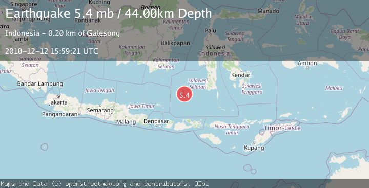
A 5.4 magnitude earthquake struck on BALI SEA, at Sun, 12 Dec 2010 15:59:21 GMT. Depth: 44km. Reviewed by EMSC seismologists, this moderate quake occurred at a magnitude type of mb.
Magnitude
5.4
mb
Source
EMSC
Intensity
-
Agency Reports
1 Sources| Source | Magnitude | Depth | Time |
|---|---|---|---|
| EMSCPrimary | 5.4 | 44 km | 15 years ago |
Earthquake Details
AutomaticEvent IDemsc_EMSC_20101212_0000034
Tsunami PotentialNo
Magnitude Typemb
Nearest Places
- 75.3 km
- 75.3 km
- 75.5 km
- 85.9 km
- 86.2 km
Comments
Join the discussion about this event.
Latest Earthquakes
1.9Mag
Southern California
Time1 hour ago
Depth11.11 km
SourceVYT (Automatic)
1.9Mag
Sweden
Time1 hour ago
Depth11.84 km
SourceVYT (Automatic)
0.8Mag
9 km NNW of Perryville, Alaska
Time1 hour ago
Depth118.40 km
SourceUSGS (Automatic)
0.5Mag
Northern Territory, Australia
Time2 hours ago
Depth5.00 km
SourceVYT (Automatic)
3.5Mag
OFF E. COAST OF N. ISLAND, N.Z.
Time2 hours ago
Depth207.40 km
SourceGNS (Automatic)
Nearby Earthquakes
3.7Mag
Bali Sea
Time2 hours ago
Depth689.45 km
SourceVYT (Automatic)
5.8Mag
BALI SEA
Time11 years ago
Depth540.00 km
SourceEMSC (Automatic)
3.7Mag
FLORES SEA
Time1 month ago
Depth5.00 km
SourceBMKG (Automatic)
4.4Mag
Bali Sea
Time3 weeks ago
Depth0.00 km
SourceBMKG (Automatic)
3.7Mag
Flores Sea
Time8 hours ago
Depth246.95 km
SourceVYT (Automatic)