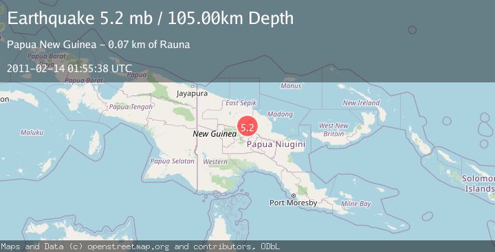
Earthquake NEW GUINEA, PAPUA NEW GUINEA
Mon, 14 Feb 2011 01:55:38 GMT
Time15 years ago
Location
-5.0700, 144.2400
Depth
105.0 KM
Event Summary
A 5.2 magnitude earthquake struck on NEW GUINEA, PAPUA NEW GUINEA, at Mon, 14 Feb 2011 01:55:38 GMT. Depth: 105km. Reviewed by EMSC seismologists, this moderate quake occurred at a magnitude type of mb.
Magnitude
5.2
mb
Source
EMSC
Intensity
-
Agency Reports
1 Sources| Source | Magnitude | Depth | Time |
|---|---|---|---|
| EMSCPrimary | 5.2 | 105 km | 15 years ago |
Earthquake Details
AutomaticEvent IDemsc_EMSC_20110214_0000003
Tsunami PotentialNo
Magnitude Typemb
Nearest Places
- Schrader Range8.3 km
- Sangapi Airport11.1 km
- Sangapi11.2 km
- Rain Mountain14.9 km
- Jimi River16.1 km
Comments
Join the discussion about this event.
Latest Earthquakes
2.2Mag
Sulawesi, Indonesia
Time7 minutes ago
Depth17.09 km
SourceBMKG
3.2Mag
Southeastern Alaska
Time10 minutes ago
Depth0.00 km
SourceVYT (Automatic)
0.8Mag
6 km WNW of Cobb, CA
Time12 minutes ago
Depth1.91 km
SourceUSGS (Automatic)
2.9Mag
STRAIT OF GIBRALTAR
Time13 minutes ago
Depth5.00 km
SourceIGN (Automatic)
0.9Mag
7 km NW of The Geysers, CA
Time16 minutes ago
Depth2.49 km
SourceUSGS (Automatic)
Nearby Earthquakes
5.2Mag
NEW GUINEA, PAPUA NEW GUINEA
Time5 years ago
Depth98.00 km
SourceEMSC (Automatic)
5.2Mag
NEW GUINEA, PAPUA NEW GUINEA
Time18 years ago
Depth103.00 km
SourceEMSC (Automatic)
5.2Mag
NEW GUINEA, PAPUA NEW GUINEA
Time9 years ago
Depth110.00 km
SourceEMSC (Automatic)
5.1Mag
NEAR N COAST OF NEW GUINEA, PNG.
Time1 year ago
Depth10.00 km
SourceEMSC (Automatic)
5.0Mag
NEAR N COAST OF NEW GUINEA, PNG.
Time3 years ago
Depth80.00 km
SourceEMSC (Automatic)