Earthquake SOUTH SANDWICH ISLANDS REGION
Mon, 07 Mar 2011 23:35:40 GMT
Time14 years ago
Location
-56.0000, -27.9000
Depth
115.0 KM
Event Summary
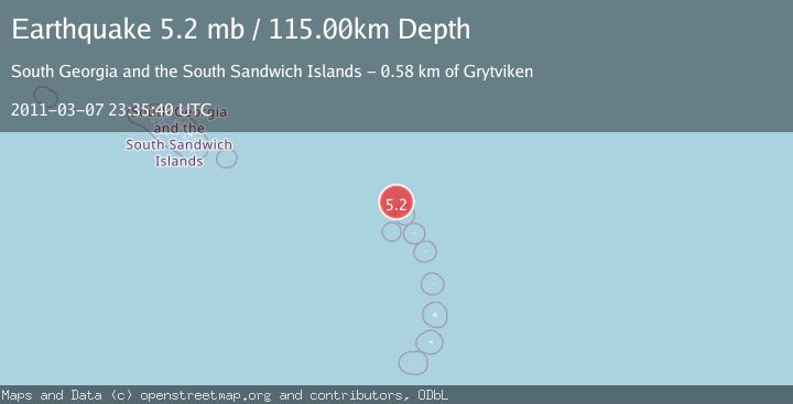
A 5.2 magnitude earthquake struck on SOUTH SANDWICH ISLANDS REGION, at Mon, 07 Mar 2011 23:35:40 GMT. Depth: 115km. Reviewed by EMSC seismologists, this moderate quake occurred at a magnitude type of mb.
Magnitude
5.2
mb
Source
EMSC
Intensity
-
Agency Reports
1 Sources| Source | Magnitude | Depth | Time |
|---|---|---|---|
| EMSCPrimary | 5.2 | 115 km | 14 years ago |
Earthquake Details
AutomaticEvent IDemsc_EMSC_20110307_0000043
Tsunami PotentialNo
Magnitude Typemb
Nearest Places
- 16.7 km
- 36.6 km
- 37.4 km
- 38.2 km
- 39.1 km
Comments
Join the discussion about this event.
Latest Earthquakes
1.8Mag
85 km NE of Tonopah, Nevada
Time7 hours ago
Depth6.04 km
SourceUSGS (Automatic)
1.8Mag
81 km NE of Tonopah, Nevada
Time7 hours ago
Depth11.57 km
SourceUSGS (Automatic)
2.1Mag
Seram, Indonesia
Time7 hours ago
Depth4.91 km
SourceBMKG
1.6Mag
94 km NE of Tonopah, Nevada
Time7 hours ago
Depth12.22 km
SourceUSGS (Automatic)
1.5Mag
PYRENEES
Time7 hours ago
Depth0.00 km
SourceIGN (Automatic)
Nearby Earthquakes
5.1Mag
SOUTH SANDWICH ISLANDS REGION
Time4 months ago
Depth113.00 km
SourceEMSC (Automatic)
5.4Mag
SOUTH SANDWICH ISLANDS REGION
Time18 years ago
Depth90.00 km
SourceEMSC (Automatic)
5.1Mag
SOUTH SANDWICH ISLANDS REGION
Time18 hours ago
Depth113.00 km
SourceEMSC (Automatic)
5.6Mag
SOUTH SANDWICH ISLANDS REGION
Time6 years ago
Depth60.00 km
SourceEMSC (Automatic)
5.1Mag
SOUTH SANDWICH ISLANDS REGION
Time1 year ago
Depth120.00 km
SourceEMSC (Automatic)