Earthquake SOUTHERN SUMATRA, INDONESIA
Wed, 13 Feb 2013 11:00:21 GMT
Time13 years ago
Location
-2.9500, 101.2600
Depth
22.0 KM
Event Summary
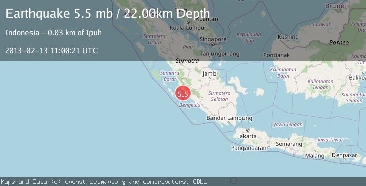
A 5.5 magnitude earthquake struck on SOUTHERN SUMATRA, INDONESIA, at Wed, 13 Feb 2013 11:00:21 GMT. Depth: 22km. Reviewed by EMSC seismologists, this moderate quake occurred at a magnitude type of mb.
Magnitude
5.5
mb
Source
EMSC
Intensity
-
Agency Reports
1 Sources| Source | Magnitude | Depth | Time |
|---|---|---|---|
| EMSCPrimary | 5.5 | 22 km | 13 years ago |
Earthquake Details
AutomaticEvent IDemsc_EMSC_20130213_0000028
Tsunami PotentialNo
Magnitude Typemb
Nearest Places
- Air Hitam16.0 km
- Desa Sinar Laut16.5 km
- Desa Air Hitam17.7 km
- Sungai Merusu18.2 km
- Desa Teluk Bakung18.3 km
Comments
Join the discussion about this event.
Latest Earthquakes
2.2Mag
Sulawesi, Indonesia
Time8 minutes ago
Depth17.09 km
SourceBMKG
3.2Mag
Southeastern Alaska
Time11 minutes ago
Depth0.00 km
SourceVYT (Automatic)
0.8Mag
6 km WNW of Cobb, CA
Time13 minutes ago
Depth1.91 km
SourceUSGS (Automatic)
2.9Mag
STRAIT OF GIBRALTAR
Time14 minutes ago
Depth5.00 km
SourceIGN (Automatic)
0.9Mag
7 km NW of The Geysers, CA
Time17 minutes ago
Depth2.49 km
SourceUSGS (Automatic)
Nearby Earthquakes
4.0Mag
SOUTHERN SUMATRA, INDONESIA
Time6 years ago
Depth84.00 km
SourceDJA (Automatic)
5.0Mag
SOUTHERN SUMATRA, INDONESIA
Time17 years ago
Depth60.00 km
SourceEMSC (Automatic)
5.7Mag
SOUTHERN SUMATRA, INDONESIA
Time17 years ago
Depth60.00 km
SourceEMSC (Automatic)
3.0Mag
SOUTHERN SUMATRA, INDONESIA
Time3 years ago
Depth20.00 km
SourceDJA (Automatic)
2.7Mag
SOUTHERN SUMATRA, INDONESIA
Time1 month ago
Depth42.00 km
SourceBMKG (Automatic)