Earthquake NEAR N COAST OF PAPUA, INDONESIA
Sat, 17 Aug 2013 07:53:03 GMT
Time12 years ago
Location
-1.9500, 139.2300
Depth
40.0 KM
Event Summary
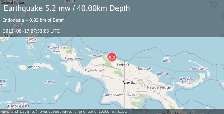
A 5.2 magnitude earthquake struck on NEAR N COAST OF PAPUA, INDONESIA, at Sat, 17 Aug 2013 07:53:03 GMT. Depth: 40km. Reviewed by EMSC seismologists, this moderate quake occurred at a magnitude type of mw.
Magnitude
5.2
mw
Source
EMSC
Intensity
-
Agency Reports
1 Sources| Source | Magnitude | Depth | Time |
|---|---|---|---|
| EMSCPrimary | 5.2 | 40 km | 12 years ago |
Earthquake Details
AutomaticEvent IDemsc_EMSC_20130817_0000033
Tsunami PotentialNo
Magnitude Typemw
Nearest Places
- Pulau Yamna5.9 km
- Pulau Mademo9.6 km
- Pulau Masimasi11.9 km
- Ansudu12.8 km
- Beneraf14.3 km
Comments
Join the discussion about this event.
Latest Earthquakes
3.3Mag
Offshore southern Greece
Time7 hours ago
Depth200.20 km
SourceVYT (Automatic)
1.9Mag
Tarapaca, Chile
Time8 hours ago
Depth109.38 km
SourceVYT (Automatic)
1.0Mag
2 km W of Anderson Springs, CA
Time8 hours ago
Depth2.07 km
SourceUSGS (Automatic)
2.5Mag
Java, Indonesia
Time8 hours ago
Depth73.53 km
SourceBMKG
1.9Mag
Tarapaca, Chile
Time8 hours ago
Depth7.93 km
SourceVYT (Automatic)
Nearby Earthquakes
5.0Mag
NEAR N COAST OF PAPUA, INDONESIA
Time18 years ago
Depth23.00 km
SourceGFZ (Automatic)
2.7Mag
NEAR N COAST OF PAPUA, INDONESIA
Time1 month ago
Depth37.00 km
SourceBMKG (Automatic)
3.0Mag
NEAR N COAST OF PAPUA, INDONESIA
Time3 years ago
Depth27.00 km
SourceDJA (Automatic)
5.2Mag
NEAR N COAST OF PAPUA, INDONESIA
Time2 years ago
Depth30.00 km
SourceEMSC (Automatic)
3.0Mag
NEAR N COAST OF PAPUA, INDONESIA
Time4 months ago
Depth10.00 km
SourceBMKG (Automatic)